MyTopo
Halstead NW Kansas US Topo Map
Couldn't load pickup availability
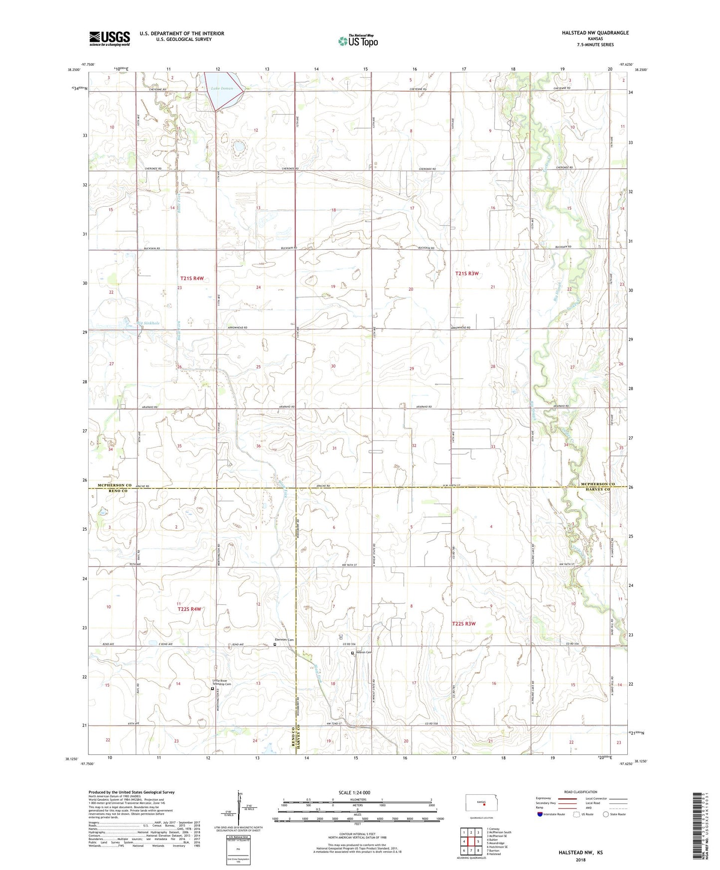
2022 topographic map quadrangle Halstead NW in the state of Kansas. Scale: 1:24000. Based on the newly updated USGS 7.5' US Topo map series, this map is in the following counties: McPherson, Harvey, Reno. The map contains contour data, water features, and other items you are used to seeing on USGS maps, but also has updated roads and other features. This is the next generation of topographic maps. Printed on high-quality waterproof paper with UV fade-resistant inks.
Quads adjacent to this one:
West: Buhler
Northwest: Conway
North: McPherson South
Northeast: McPherson SE
East: Moundridge
Southeast: Halstead
South: Burrton
Southwest: Hutchinson SE
This map covers the same area as the classic USGS quad with code o38097b6.
Contains the following named places: Big Sinkhole, Big Slough, Buhler East Cemetery, Dry Turkey Creek, Hebron Cemetery, Hoffnungsau Mennonite Church, Hollow Nikkel Oil Field, Lake Inman, Little River Township Cemetery, Sparta, Township of Alta, Township of Turkey Creek