MyTopo
Cloverdale Kansas US Topo Map
Couldn't load pickup availability
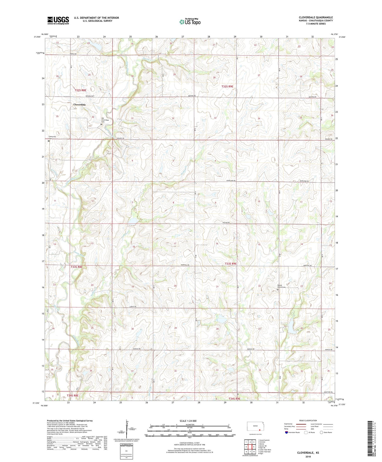
2023 topographic map quadrangle Cloverdale in the state of Kansas. Scale: 1:24000. Based on the newly updated USGS 7.5' US Topo map series, this map is in the following counties: Chautauqua. The map contains contour data, water features, and other items you are used to seeing on USGS maps, but also has updated roads and other features. This is the next generation of topographic maps. Printed on high-quality waterproof paper with UV fade-resistant inks.
Quads adjacent to this one:
West: Dexter NE
Northwest: Grand Summit
North: Grenola
Northeast: Moline
East: Elgin NE
Southeast: Elgin
South: Cedar Vale East
Southwest: Cedar Vale West
This map covers the same area as the classic USGS quad with code o37096b4.
Contains the following named places: Caneyville Cemetery, Cloverdale, Leeds, Old Cloverdale Cemetery, Otter Creek, Round Mound Cemetery, Round Mound Church, Squaw Creek, Township of Jefferson, Turkey Creek, Union Creek