MyTopo
Cheney SE Kansas US Topo Map
Couldn't load pickup availability
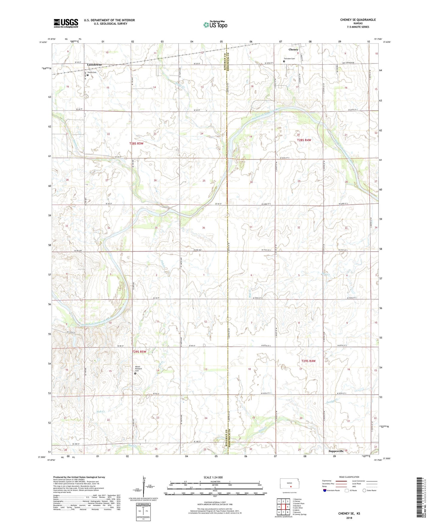
2022 topographic map quadrangle Cheney SE in the state of Kansas. Scale: 1:24000. Based on the newly updated USGS 7.5' US Topo map series, this map is in the following counties: Kingman, Sedgwick. The map contains contour data, water features, and other items you are used to seeing on USGS maps, but also has updated roads and other features. This is the next generation of topographic maps. Printed on high-quality waterproof paper with UV fade-resistant inks.
Quads adjacent to this one:
West: Murdock
Northwest: Waterloo
North: Cheney
Northeast: Garden Plain
East: Lake Afton
Southeast: Conway Springs
South: Norwich
Southwest: Adams
This map covers the same area as the classic USGS quad with code o37097e7.
Contains the following named places: Broadway Oil and Gas Field, Fairview Cemetery, Fish Creek, Glendale School, Lansdowne, Mount Pleasant Cemetery, Nester Creek, Pleasant Valley School, Sedgwick County Fairgrounds, Smoots Creek, Township of Allen, Township of Erie, Township of Morton, Township of Vinita, Vinita Cemetery