MyTopo
Longton Kansas US Topo Map
Couldn't load pickup availability
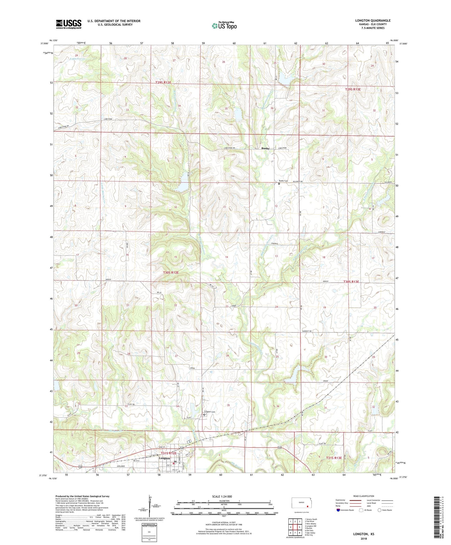
2022 topographic map quadrangle Longton in the state of Kansas. Scale: 1:24000. Based on the newly updated USGS 7.5' US Topo map series, this map is in the following counties: Elk. The map contains contour data, water features, and other items you are used to seeing on USGS maps, but also has updated roads and other features. This is the next generation of topographic maps. Printed on high-quality waterproof paper with UV fade-resistant inks.
Quads adjacent to this one:
West: Longton NW
Northwest: Severy South
North: Fall River
Northeast: New Albany
East: Buxton
Southeast: Elk City
South: Oak Valley
Southwest: Elk Falls
This map covers the same area as the classic USGS quad with code o37096d1.
Contains the following named places: Busby, Busby Cemetery, Christian Community Church, City of Longton, East Painterhood Creek, Elk County Rural Fire District Longton Fire Department, Elk Valley Elementary School, Elk Valley Junior / Senior High School, First Baptist Church, Hitchen Creek, Longton, Longton Cemetery, Longton City Hall, Longton Fire Department, Longton Oil and Gas Field, Longton Post Office, Longton Public Library, Longton Sewer Treatment Plant, Longton United Methodist Church, Mid Painterhood Creek, Ohio Townhall, Painterhood Creek, Rancho, Township of Painterhood, West Painterhood Creek, ZIP Code: 67352