MyTopo
Ellinwood Kansas US Topo Map
Couldn't load pickup availability
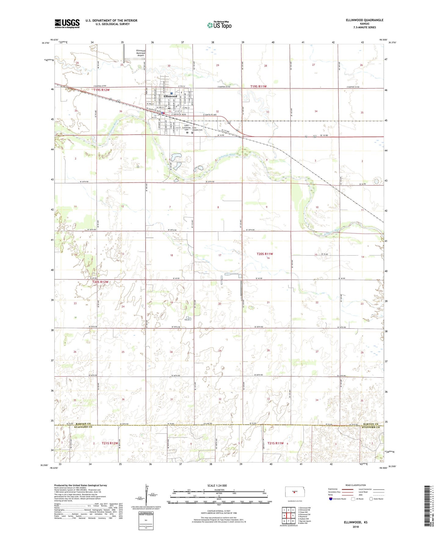
2022 topographic map quadrangle Ellinwood in the state of Kansas. Scale: 1:24000. Based on the newly updated USGS 7.5' US Topo map series, this map is in the following counties: Barton, Stafford. The map contains contour data, water features, and other items you are used to seeing on USGS maps, but also has updated roads and other features. This is the next generation of topographic maps. Printed on high-quality waterproof paper with UV fade-resistant inks.
Quads adjacent to this one:
West: Ellinwood SW
Northwest: Ellinwood NW
North: Ellinwood NE
Northeast: Chase NW
East: Raymond
Southeast: Alden NW
South: Big Salt Marsh
Southwest: Hudson NW
This map covers the same area as the classic USGS quad with code o38098c5.
Contains the following named places: Calvary Baptist Church, City of Ellinwood, Ellinwood, Ellinwood City Hall, Ellinwood District Hospital, Ellinwood Emergency Medical Services, Ellinwood Fire Department, Ellinwood First Baptist Church, Ellinwood Grade School, Ellinwood High School, Ellinwood Middle School, Ellinwood Municipal Airport, Ellinwood Police Department, Ellinwood Post Office, Ellinwood School Community Library, Ellinwood United Methodist Church, Ellinwood Wastewater Plant, Great Bend Co - Operative Association Grain Elevator Number 5, Grove Park Golf Course, Immanuel United Church of Christ, Lakin - Comanche Cemetery, Lakin Comanche Cemetery, Pleasant Valley School, Saint John's Lutheran Church, Saint Joseph Catholic School, Saint Joseph's Catholic Church, South Side Mobile Court, Township of Comanche, ZIP Code: 67526