MyTopo
Chase NW Kansas US Topo Map
Couldn't load pickup availability
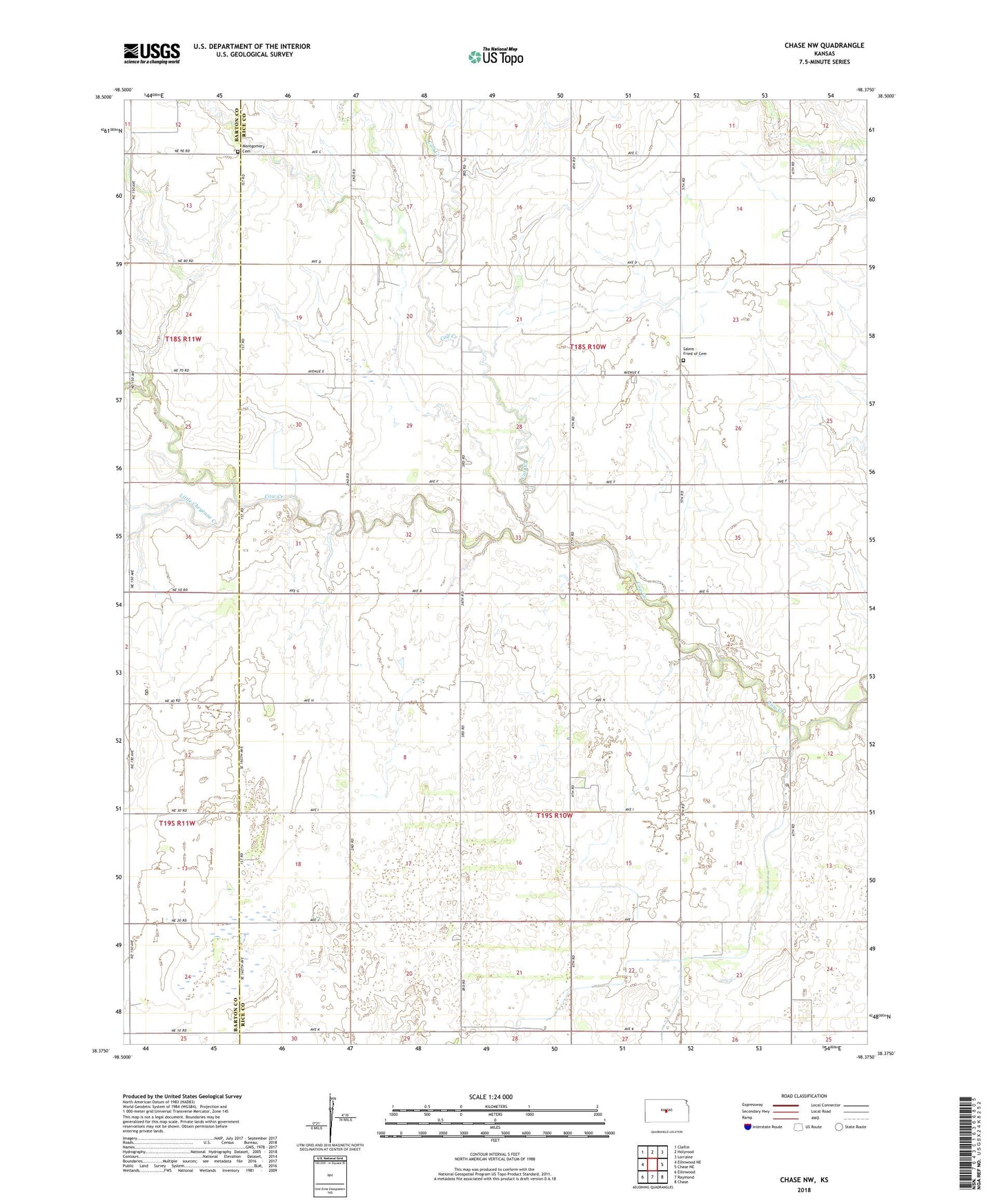
2022 topographic map quadrangle Chase NW in the state of Kansas. Scale: 1:24000. Based on the newly updated USGS 7.5' US Topo map series, this map is in the following counties: Rice, Barton. The map contains contour data, water features, and other items you are used to seeing on USGS maps, but also has updated roads and other features. This is the next generation of topographic maps. Printed on high-quality waterproof paper with UV fade-resistant inks.
Quads adjacent to this one:
West: Ellinwood NE
Northwest: Claflin
North: Holyrood
Northeast: Lorraine
East: Chase NE
Southeast: Chase
South: Raymond
Southwest: Ellinwood
This map covers the same area as the classic USGS quad with code o38098d4.
Contains the following named places: Calf Creek, Calf Creek Oil Field, Chase-Silica Oil Field, Glen Sharrald, Holy Name Catholic Church, IXL Oil Field, Little Cheyenne Creek, Mary Ida Oil Field, Montgomery Cemetery, Orth Oil Field, Orth West Oil Field, Ringwald Oil Field, Salem - Friedhof Cemetery, Salem United Methodist Church, State of Kansas, Township of Farmer, Township of Pioneer, ZIP Code: 67427