MyTopo
Ellinwood NW Kansas US Topo Map
Couldn't load pickup availability
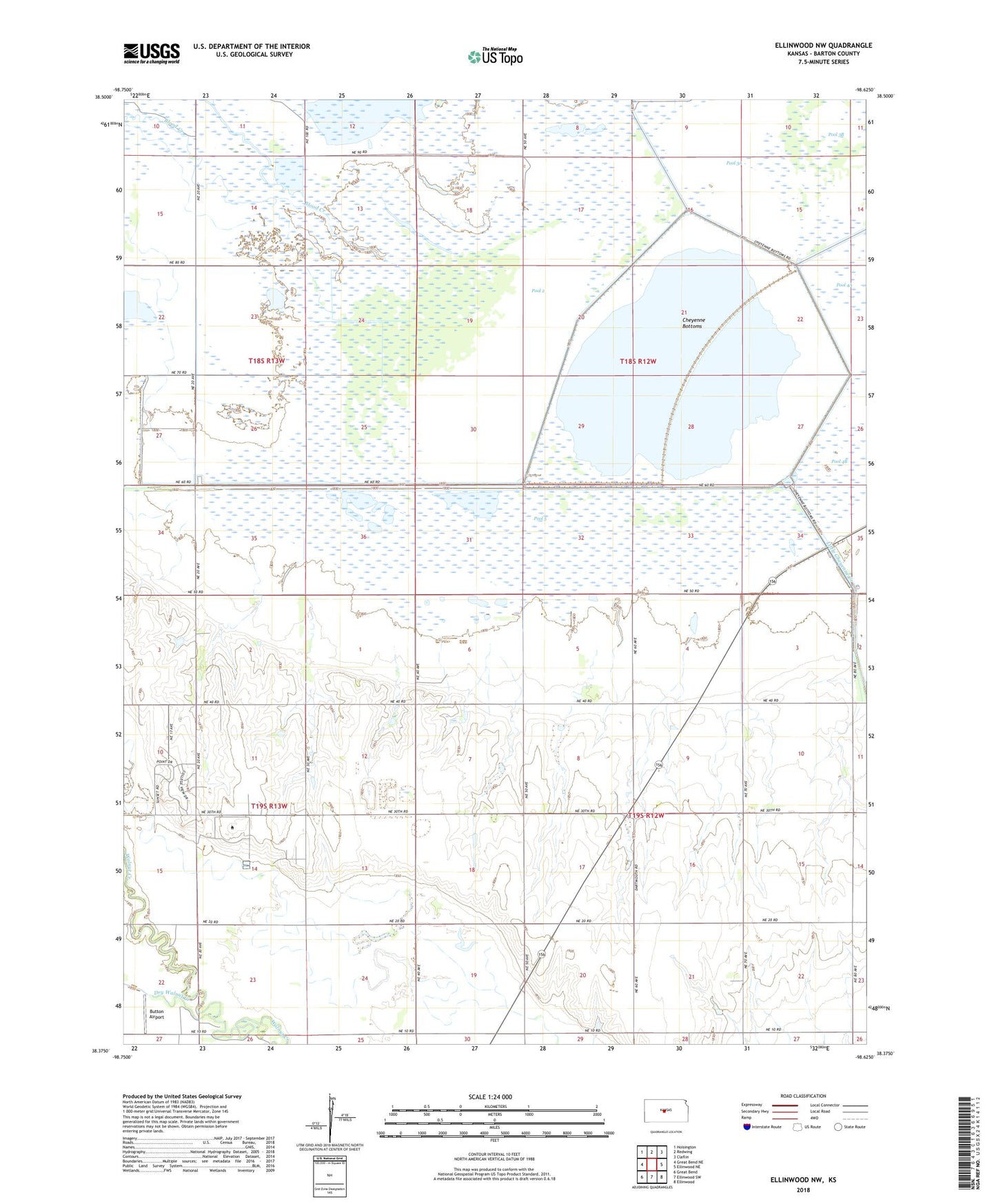
2022 topographic map quadrangle Ellinwood NW in the state of Kansas. Scale: 1:24000. Based on the newly updated USGS 7.5' US Topo map series, this map is in the following counties: Barton. The map contains contour data, water features, and other items you are used to seeing on USGS maps, but also has updated roads and other features. This is the next generation of topographic maps. Printed on high-quality waterproof paper with UV fade-resistant inks.
Quads adjacent to this one:
West: Great Bend NE
Northwest: Hoisington
North: Redwing
Northeast: Claflin
East: Ellinwood NE
Southeast: Ellinwood
South: Ellinwood SW
Southwest: Great Bend
This map covers the same area as the classic USGS quad with code o38098d6.
Contains the following named places: Barton Community College - A Building, Barton Community College - C Building, Barton Community College - F Building, Barton Community College - L Building, Barton Community College - P Building, Barton Community College - S Building, Barton Community College - T Building, Barton Community College - U Building, Barton Community College Child Development Center, Barton Community College Kirkman Student Activity Center, Barton Community College Planetarium, Barton County Community College, Barton County Community College Water Treatment Facility, Barton County Landfill, Blood Creek, Button Airport, Cheyenne Bottoms, Cheyenne Bottoms Wildlife Area, Cheyenne View School, Community Christian Church, Dry Walnut Creek, Fort Hays State University Kansas Wetlands Education Center, Fort Zarah, KBJC-FM (Great Bend), L E Gus and Eva Shafer Memorial Art Gallery, Pool 1A, Pool 1B, Pool 1C, Pool 2, Pool 3A, Pool 3B, Pool 5, Township of Great Bend