MyTopo
Claflin Kansas US Topo Map
Couldn't load pickup availability
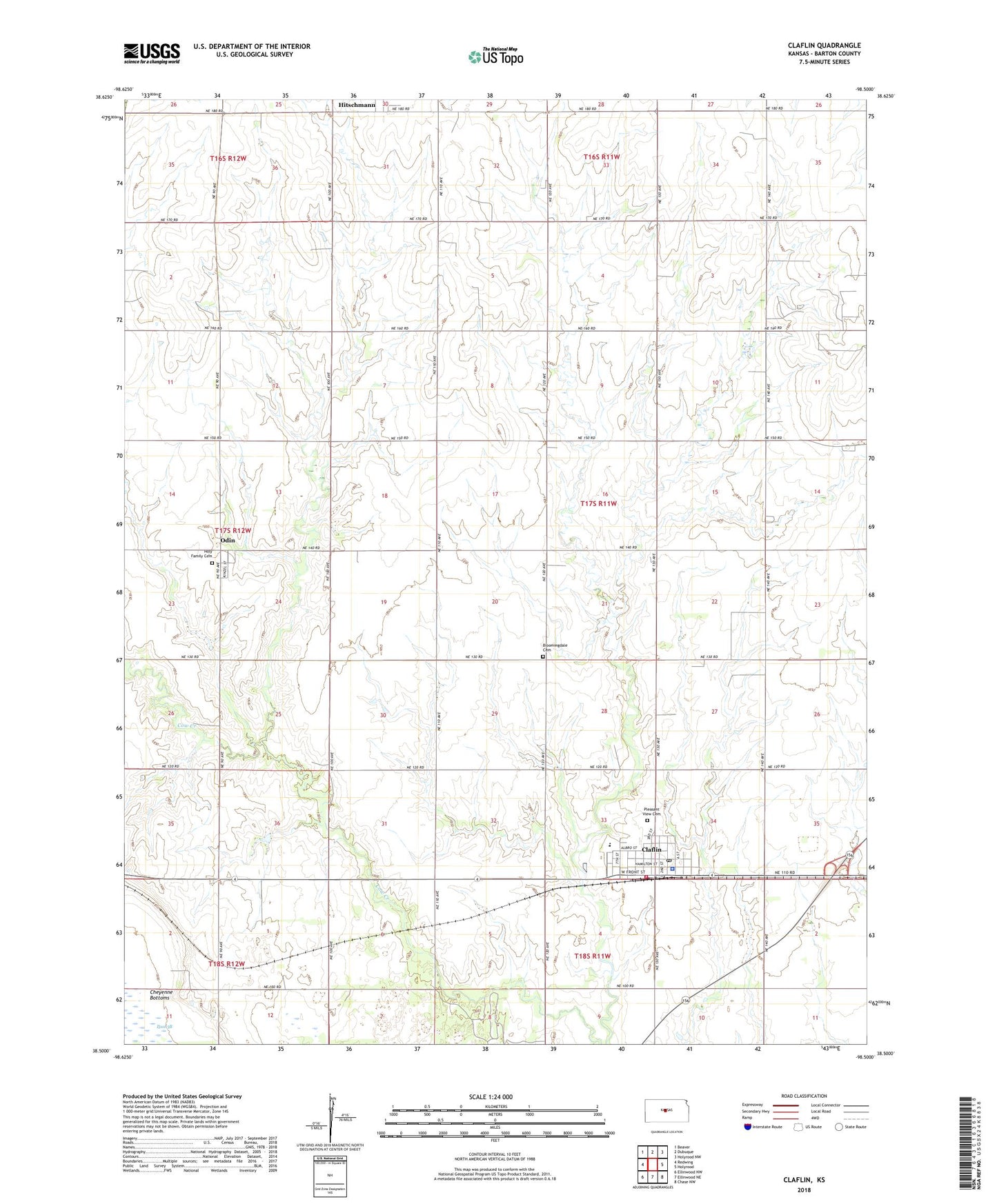
2022 topographic map quadrangle Claflin in the state of Kansas. Scale: 1:24000. Based on the newly updated USGS 7.5' US Topo map series, this map is in the following counties: Barton. The map contains contour data, water features, and other items you are used to seeing on USGS maps, but also has updated roads and other features. This is the next generation of topographic maps. Printed on high-quality waterproof paper with UV fade-resistant inks.
Quads adjacent to this one:
West: Redwing
Northwest: Beaver
North: Dubuque
Northeast: Holyrood NW
East: Holyrood
Southeast: Chase NW
South: Ellinwood NE
Southwest: Ellinwood NW
This map covers the same area as the classic USGS quad with code o38098e5.
Contains the following named places: Bloomingdale Cemetery, Brooklyn, City of Claflin, Claflin, Claflin Ambulance Service Association, Claflin City Hall, Claflin Community Building, Claflin Elementary School, Claflin Fire Department, Claflin High School, Claflin Police Department, Claflin Post Office, Claflin United Methodist Church, Claflin Wastewater Plant, Faith in Motion Worship Arts Center, Hitschmann, Holy Family Cemetery, Immaculate Conception Church, Independent Township Library, Odin, Odin Census Designated Place, Pleasant View Cemetery, Township of Independent, Zion Lutheran Church, ZIP Code: 67525