MyTopo
Elmer Kansas US Topo Map
Couldn't load pickup availability
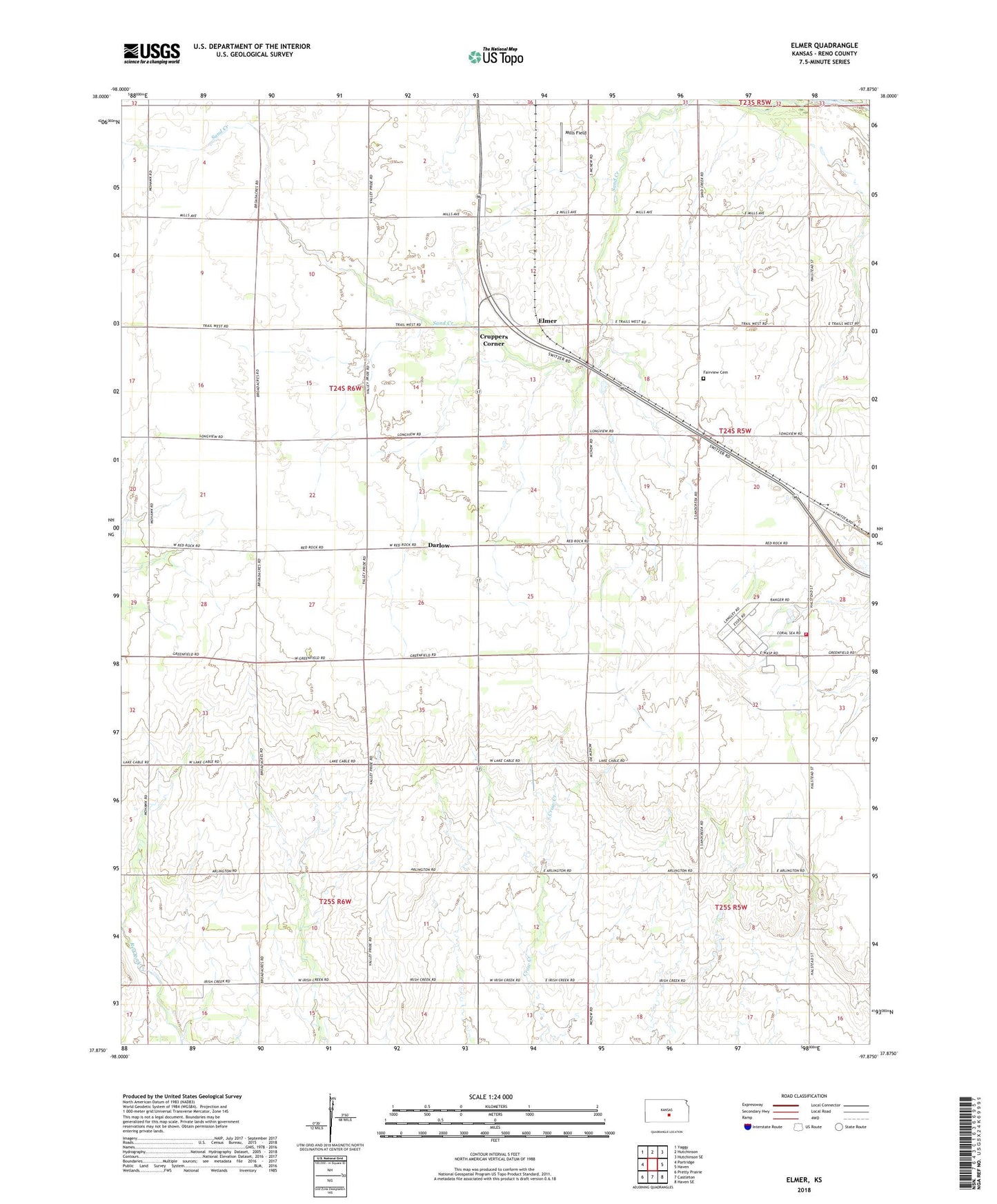
2022 topographic map quadrangle Elmer in the state of Kansas. Scale: 1:24000. Based on the newly updated USGS 7.5' US Topo map series, this map is in the following counties: Reno. The map contains contour data, water features, and other items you are used to seeing on USGS maps, but also has updated roads and other features. This is the next generation of topographic maps. Printed on high-quality waterproof paper with UV fade-resistant inks.
Quads adjacent to this one:
West: Partridge
Northwest: Yaggy
North: Hutchinson
Northeast: Hutchinson SE
East: Haven
Southeast: Haven SE
South: Castleton
Southwest: Pretty Prairie
This map covers the same area as the classic USGS quad with code o37097h8.
Contains the following named places: Cruppers Corner, Darlow, Elmer, Fairview Cemetery, Hutchinson Air Force Station, Hutchinson Community College South Campus Cameron Hall, Hutchinson Community College South Campus Pioneer Hall, Hutchinson Community College South Campus Wagner Hall, Irish Creek Airfield, Mills Field, Pleasant View Church, Reno County Fire District 8 Station 1, Reno County Sewer District Number 202, Sand Creek, Sunflower Aerodrome, Township of Kinsley, Township of Lincoln, ZIP Code: 67501