MyTopo
Elmont Kansas US Topo Map
Couldn't load pickup availability
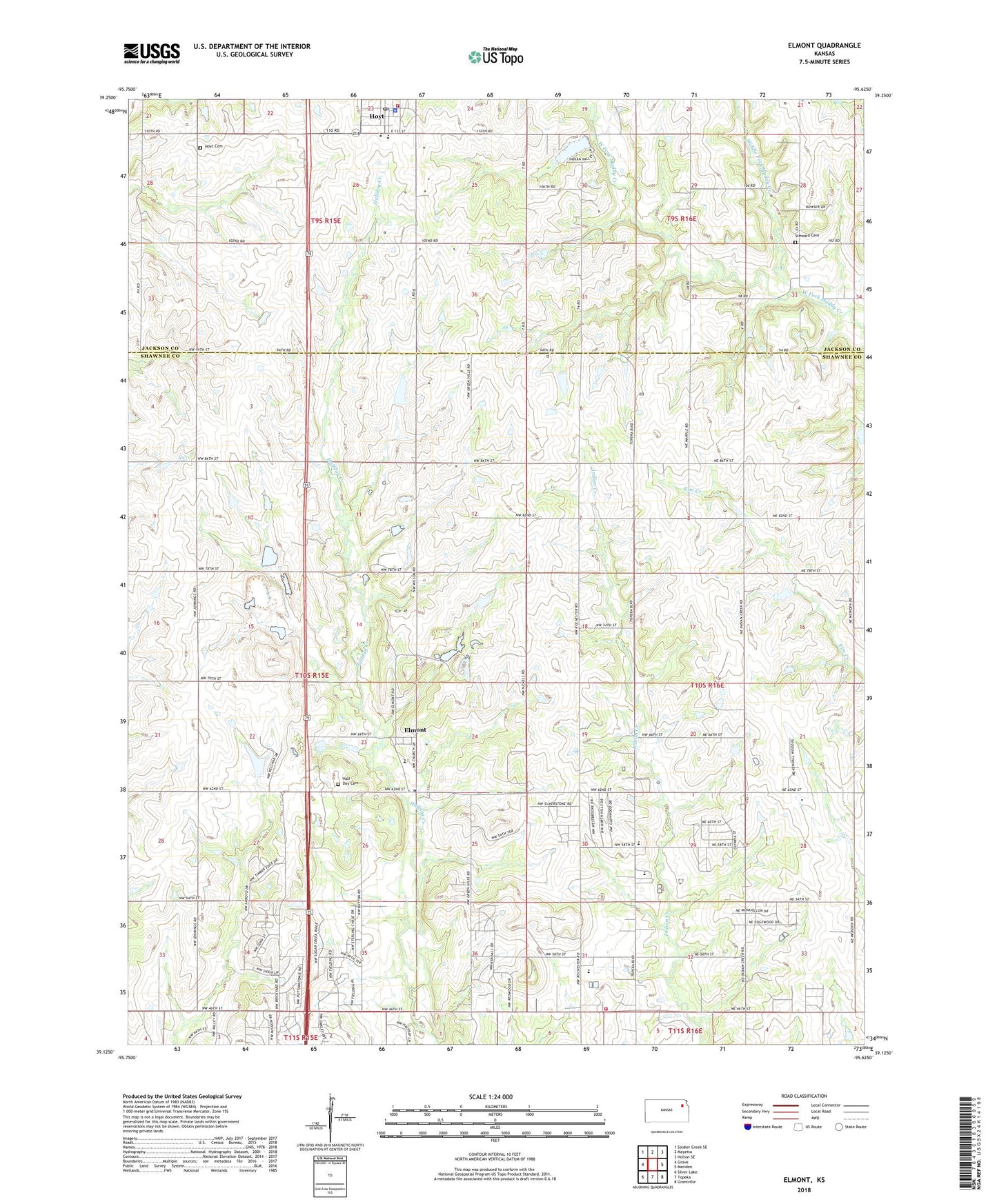
2022 topographic map quadrangle Elmont in the state of Kansas. Scale: 1:24000. Based on the newly updated USGS 7.5' US Topo map series, this map is in the following counties: Shawnee, Jackson. The map contains contour data, water features, and other items you are used to seeing on USGS maps, but also has updated roads and other features. This is the next generation of topographic maps. Printed on high-quality waterproof paper with UV fade-resistant inks.
Quads adjacent to this one:
West: Grove
Northwest: Soldier Creek SE
North: Mayetta
Northeast: Holton SE
East: Meriden
Southeast: Grantville
South: Topeka
Southwest: Silver Lake
This map covers the same area as the classic USGS quad with code o39095b6.
Contains the following named places: Capital View Elementary School, City of Hoyt, Elmont, Elmont Elementary School, Elmont United Methodist Church, Family Life Church of the Nazarene, Grace Missionary Baptist Church, Half - Day Cemetery, Hoyt, Hoyt Baptist Church, Hoyt Cemetery, Hoyt Police Department, Hoyt Post Office, Hoyt Rural Fire District 3, Hoyt United Methodist Church, KMAJ-FM (Topeka), Mesa Verde Airport, Middle Fork Muddy Creek, Northern Hills Baptist Church, Northside Church of Christ, Northview Mobile Home Park, Pleasant Hill Learning Campus, Pleasant Hill United Methodist Church, Rock School, Rolling Hills Christian Church, Royal Valley Elementary School, Royal Valley High School, Seaman High School, Seaman Middle School, Shawnee County Indian Creek Wastewater Treatment Plant, Shawnee North Community Center, Shawnee North Community Center Wastewater Treatment Facility, Soldier Township Fire Department, South Hoyt School, Steward Cemetery, Township of Soldier, ZIP Code: 66618