MyTopo
Mayetta Kansas US Topo Map
Couldn't load pickup availability
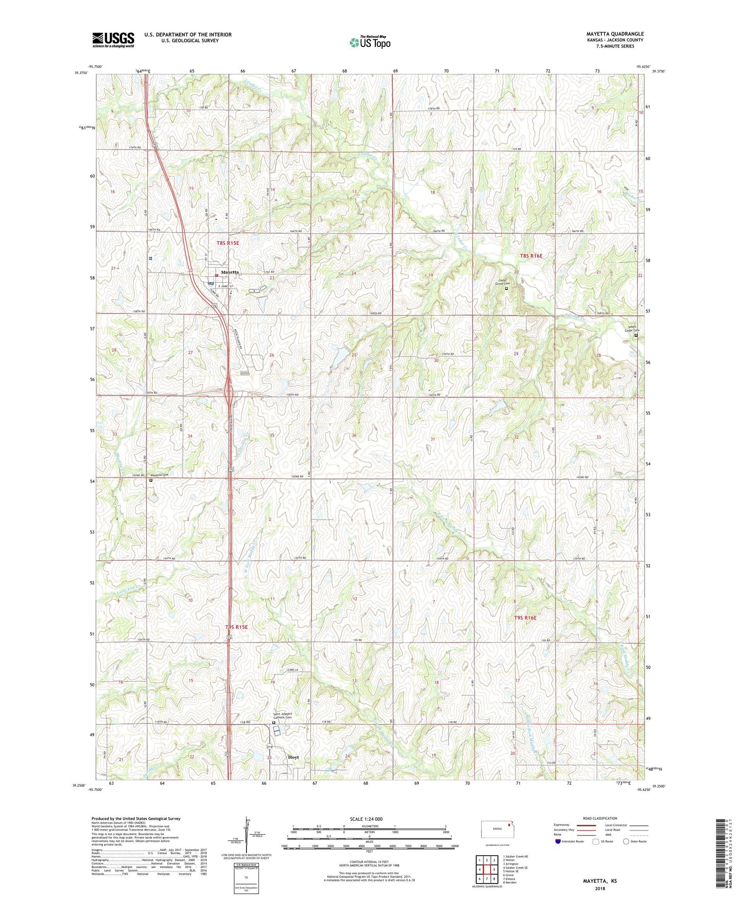
2022 topographic map quadrangle Mayetta in the state of Kansas. Scale: 1:24000. Based on the newly updated USGS 7.5' US Topo map series, this map is in the following counties: Jackson. The map contains contour data, water features, and other items you are used to seeing on USGS maps, but also has updated roads and other features. This is the next generation of topographic maps. Printed on high-quality waterproof paper with UV fade-resistant inks.
Quads adjacent to this one:
West: Soldier Creek SE
Northwest: Soldier Creek NE
North: Holton
Northeast: Arrington
East: Holton SE
Southeast: Meriden
South: Elmont
Southwest: Grove
This map covers the same area as the classic USGS quad with code o39095c6.
Contains the following named places: Bell School, Cedar Grove Cemetery, Cedar Valley Church, City of Mayetta, Hoyt Elementary School, Hoyt Rural Water District Wastewater Treatment Facility, Mayetta, Mayetta Cemetery, Mayetta Christian Church, Mayetta Elementary School, Mayetta Police Department, Mayetta Post Office, Mayetta Rural Fire District 1, Mayetta Sewer Treatment Plant, Point Pleasant School, Prairie Band Potawatomi Nation Government Center, Prairie Band Potawatomi Tribal Police Department, Ray School, Royal Valley Middle School, Royal Valley Unified School District Office, Saint Francis Xavier Church, Saint Joseph's Catholic Cemetery, South Cedar, South Cedar Cemetery, South Cedar School, Township of Cedar, Township of Douglas, ZIP Code: 66440