MyTopo
Holton SE Kansas US Topo Map
Couldn't load pickup availability
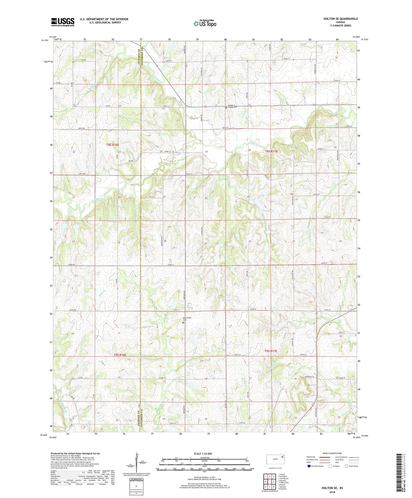
2022 topographic map quadrangle Holton SE in the state of Kansas. Scale: 1:24000. Based on the newly updated USGS 7.5' US Topo map series, this map is in the following counties: Jefferson, Jackson. The map contains contour data, water features, and other items you are used to seeing on USGS maps, but also has updated roads and other features. This is the next generation of topographic maps. Printed on high-quality waterproof paper with UV fade-resistant inks.
Quads adjacent to this one:
West: Mayetta
Northwest: Holton
North: Arrington
Northeast: Half Mound
East: Valley Falls
Southeast: Ozawkie
South: Meriden
Southwest: Elmont
This map covers the same area as the classic USGS quad with code o39095c5.
Contains the following named places: Bloomfield Cemetery, Booker Creek, Graggs Chapel Cemetery, Jefferson City, North Cedar Creek, South Cedar Creek, United Brethren Church, ZIP Code: 66419