MyTopo
Meriden Kansas US Topo Map
Couldn't load pickup availability
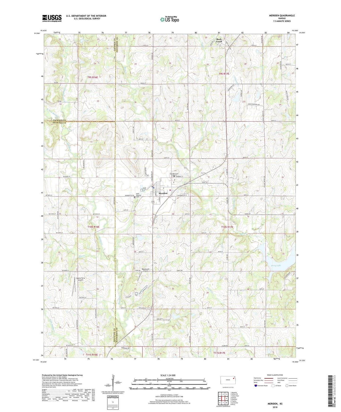
2022 topographic map quadrangle Meriden in the state of Kansas. Scale: 1:24000. Based on the newly updated USGS 7.5' US Topo map series, this map is in the following counties: Jefferson, Shawnee, Jackson. The map contains contour data, water features, and other items you are used to seeing on USGS maps, but also has updated roads and other features. This is the next generation of topographic maps. Printed on high-quality waterproof paper with UV fade-resistant inks.
Quads adjacent to this one:
West: Elmont
Northwest: Mayetta
North: Holton SE
Northeast: Valley Falls
East: Ozawkie
Southeast: Perry
South: Grantville
Southwest: Topeka
This map covers the same area as the classic USGS quad with code o39095b5.
Contains the following named places: Adam Ranch, Anderson Mobile Home Park, Blackhawk Airport, Buena Terra Airport, City of Meriden, Claywell Creek, Cotton - O'Neil Meriden Clinic, Dix School, Durand's Greenhouse, East Fork Muddy Creek, Elm Creek, Fin and Feather Lake, Jackson Farmers Grain Elevator Number 5, Jefferson West Elementary School, Jefferson West High School, Jefferson West Middle School, Jefferson West Unified School District Central Office, Kilmer, Meriden, Meriden Cemetery, Meriden Community Library, Meriden Police Department, Meriden Post Office, Meriden Sewer Treatment Plant, Rock Creek, Rock Creek Township Fire Department, Saint Aloysius Catholic Church, Saint Aloysius Cemetery, Sunbeam School, Tick Creek, Township of Rock Creek, Village Greens Golf Course, West Fork Muddy Creek, ZIP Codes: 66512, 66617