MyTopo
Galatia Kansas US Topo Map
Couldn't load pickup availability
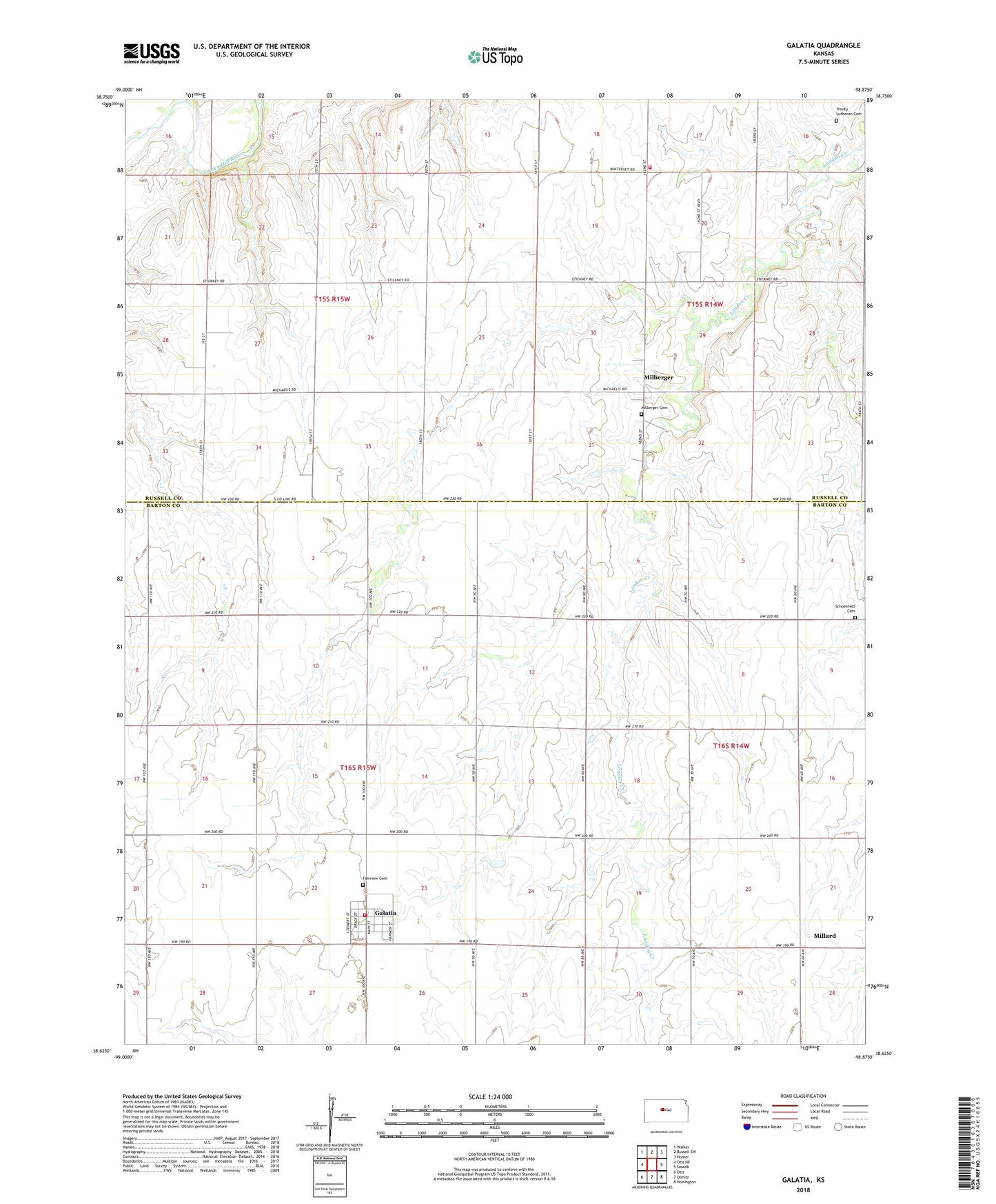
2022 topographic map quadrangle Galatia in the state of Kansas. Scale: 1:24000. Based on the newly updated USGS 7.5' US Topo map series, this map is in the following counties: Barton, Russell. The map contains contour data, water features, and other items you are used to seeing on USGS maps, but also has updated roads and other features. This is the next generation of topographic maps. Printed on high-quality waterproof paper with UV fade-resistant inks.
Quads adjacent to this one:
West: Otis NE
Northwest: Walker
North: Russell SW
Northeast: Homer
East: Susank
Southeast: Hoisington
South: Olmitz
Southwest: Otis
This map covers the same area as the classic USGS quad with code o38098f8.
Contains the following named places: Bartondale, Boxberger West Oil Field, City of Galatia, Fairview Cemetery, Galatia, Galatia Volunteer Fire Department, Immanuel Church, Lincoln School, Milberger, Milberger Cemetery, Millard, Nuss Oil Field, Roosevelt Oil Field, Russell County Rural Fire District 5 Lincoln Station, Saint Paul Lutheran Church, Schoenfeld Cemetery, Strecker Oil Field, Strick Oil Field, Township of Fairview, Township of Winterset, Trinity Lutheran Cemetery, United Agricultural Service Grain Elevator Number 2, United Emmanuel Lutheran Church