MyTopo
Susank Kansas US Topo Map
Couldn't load pickup availability
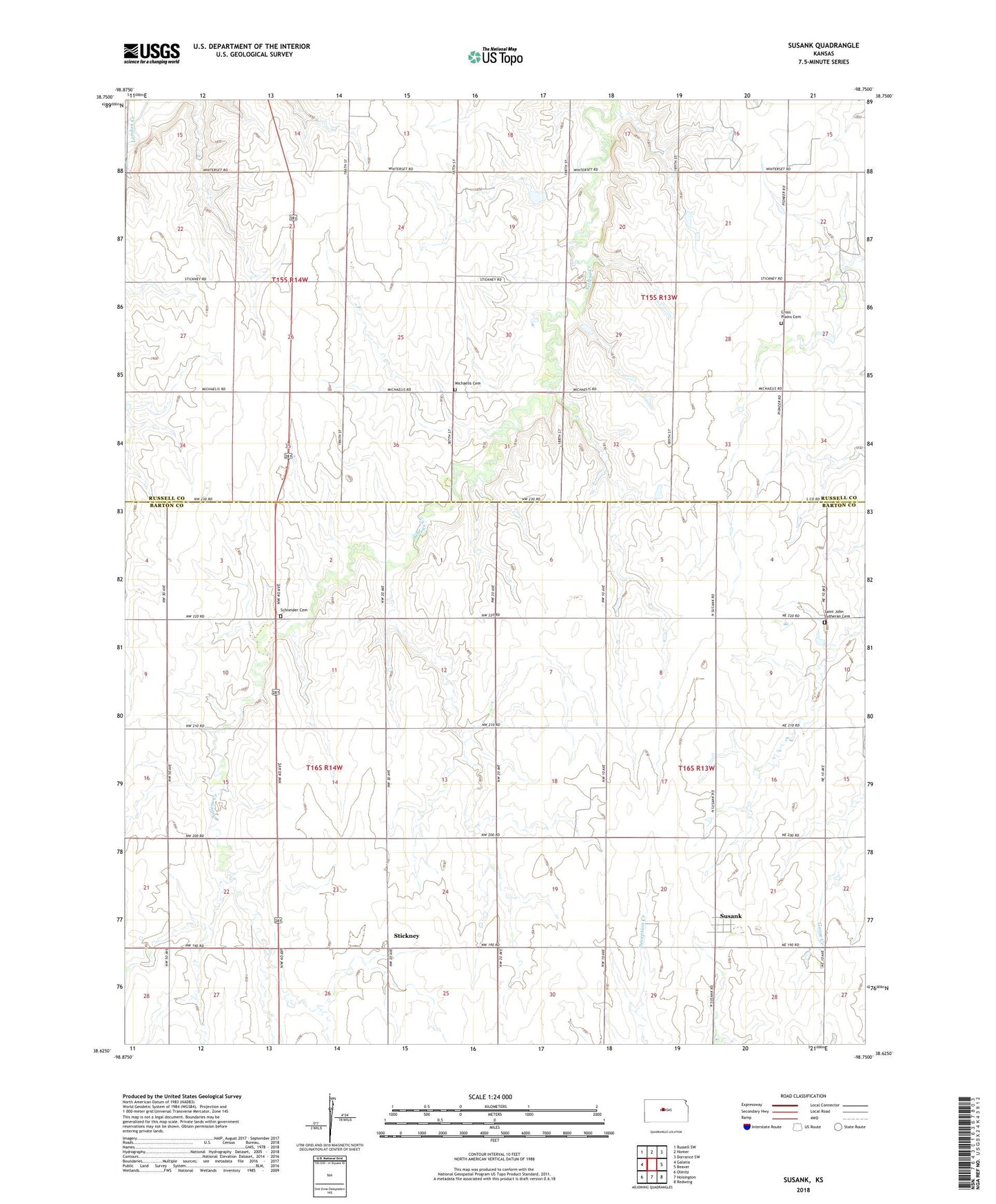
2022 topographic map quadrangle Susank in the state of Kansas. Scale: 1:24000. Based on the newly updated USGS 7.5' US Topo map series, this map is in the following counties: Barton, Russell. The map contains contour data, water features, and other items you are used to seeing on USGS maps, but also has updated roads and other features. This is the next generation of topographic maps. Printed on high-quality waterproof paper with UV fade-resistant inks.
Quads adjacent to this one:
West: Galatia
Northwest: Russell SW
North: Homer
Northeast: Dorrance SW
East: Beaver
Southeast: Redwing
South: Hoisington
Southwest: Olmitz
This map covers the same area as the classic USGS quad with code o38098f7.
Contains the following named places: City of Susank, Cross Plains Cemetery, KOCW - TV (Wichita), Michaelis Cemetery, Saint John Lutheran Cemetery, Schneider Cemetery, Shannon Friends Church, Stickney, Susank, Susank Wastewater Plant, Templing Oil Field, Township of Fairfield, Township of Lincoln, Township of Union, Township of Wheatland, United Agricultural Service Grain Elevator Number 6