MyTopo
Galesburg Kansas US Topo Map
Couldn't load pickup availability
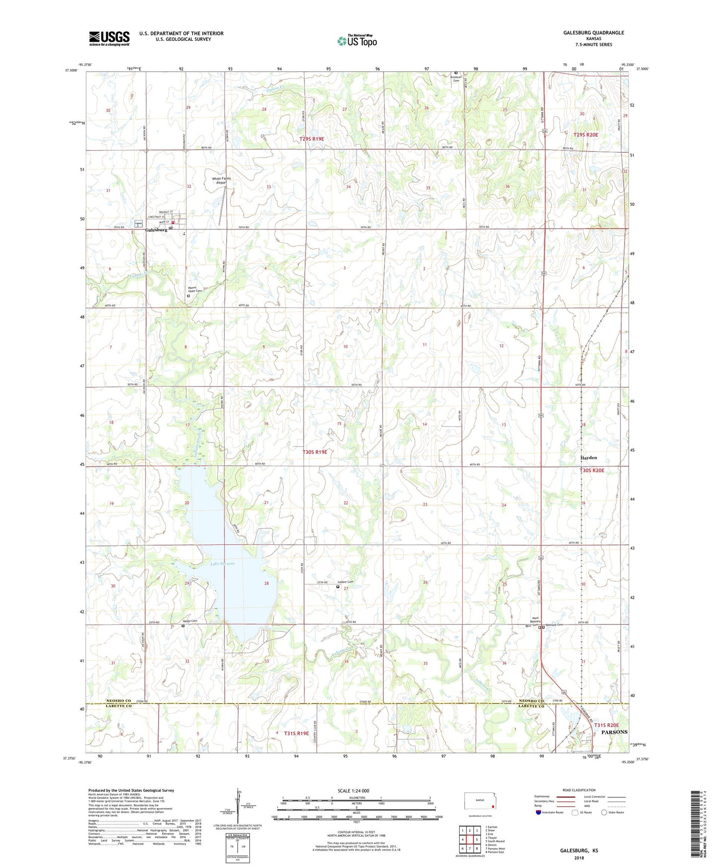
2022 topographic map quadrangle Galesburg in the state of Kansas. Scale: 1:24000. Based on the newly updated USGS 7.5' US Topo map series, this map is in the following counties: Neosho, Labette. The map contains contour data, water features, and other items you are used to seeing on USGS maps, but also has updated roads and other features. This is the next generation of topographic maps. Printed on high-quality waterproof paper with UV fade-resistant inks.
Quads adjacent to this one:
West: Thayer
Northwest: Earlton
North: Shaw
Northeast: Erie
East: South Mound
Southeast: Parsons East
South: Parsons West
Southwest: Dennis
This map covers the same area as the classic USGS quad with code o37095d3.
Contains the following named places: Brethren Cemetery, Brethren Church, Catalpa School, Centerville School, City of Galesburg, Danville School, East Bethany Cemetery, Excelsior Church, Excelsior School, Galesburg, Galesburg Christian Church, Galesburg Middle School, Galesburg Post Office, Galesburg United Methodist Church, Galesburg Volunteer Fire Department, Galesburg Wastewater Treatment Plant, Hayden, Ladore, Ladore Cemetery, Ladore Church, Ladore School, Lake Parsons, Lake Parsons Dam, M K T School, Mount Hope Cemetery, Pontious Family Farm, Sand Hill School, Sunnyside School, Township of Ladore, Valley Cemetery, Valley School, West Bethany Cemetery, White Farms Airport, ZIP Code: 66740