MyTopo
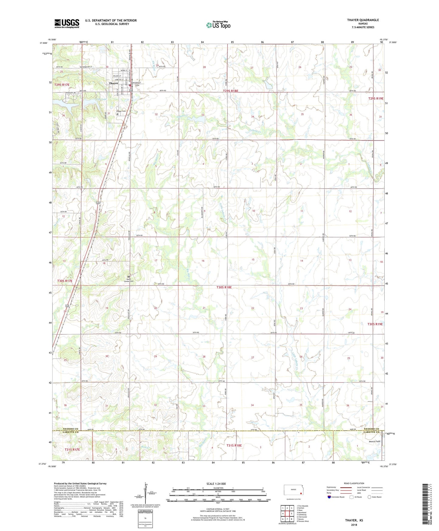
Thayer Kansas US Topo Map
Couldn't load pickup availability
2022 topographic map quadrangle Thayer in the state of Kansas. Scale: 1:24000. Based on the newly updated USGS 7.5' US Topo map series, this map is in the following counties: Neosho, Labette. The map contains contour data, water features, and other items you are used to seeing on USGS maps, but also has updated roads and other features. This is the next generation of topographic maps. Printed on high-quality waterproof paper with UV fade-resistant inks.
Quads adjacent to this one:
West: Morehead
Northwest: Five Mounds
North: Earlton
Northeast: Shaw
East: Galesburg
Southeast: Parsons West
South: Dennis
Southwest: Cherryvale
This map covers the same area as the classic USGS quad with code o37095d4.
Contains the following named places: Beachner Grain Elevator Number 15, City Lake, City of Thayer, Fairview School, Hazel Dell School, New Hope School, Otterbein United Brethren Church, Pearce Field, Sapp School, Shiloh School, South Center Cemetery, South Center School, Thayer, Thayer Cemetery, Thayer Christian Church, Thayer City Dam, Thayer City Hall, Thayer Elementary School, Thayer Fire Department, Thayer Friday Reading Club Library, Thayer High School, Thayer Post Office, Thayer Seventh Day Adventist Church, Thayer Sewer Treatment Plant, Thayer United Methodist Church, Township of Shiloh, ZIP Code: 66776