MyTopo
Parsons West Kansas US Topo Map
Couldn't load pickup availability
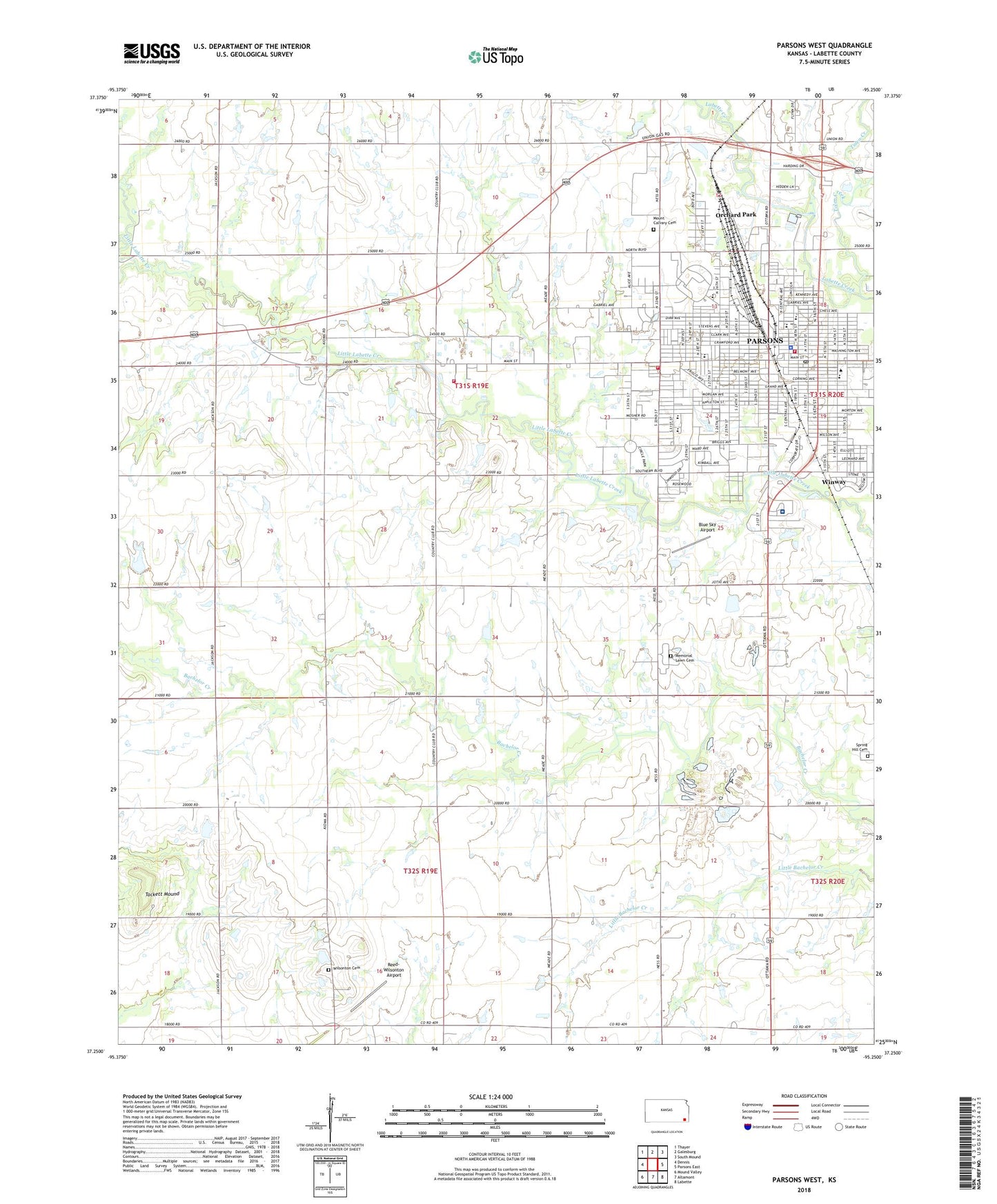
2022 topographic map quadrangle Parsons West in the state of Kansas. Scale: 1:24000. Based on the newly updated USGS 7.5' US Topo map series, this map is in the following counties: Labette. The map contains contour data, water features, and other items you are used to seeing on USGS maps, but also has updated roads and other features. This is the next generation of topographic maps. Printed on high-quality waterproof paper with UV fade-resistant inks.
Quads adjacent to this one:
West: Dennis
Northwest: Thayer
North: Galesburg
Northeast: South Mound
East: Parsons East
Southeast: Labette
South: Altamont
Southwest: Mound Valley
This map covers the same area as the classic USGS quad with code o37095c3.
Contains the following named places: Arvon Phillips Community Center, Beachner Grain Elevator Number 1, Belmont Square, Berean Baptist Church, Blue Sky Airport, Blum, Brown Chapel African Methodist Episcopal Church, Caldwell School, Calvary Baptist Church, Church of Christ, Church of God, Church of the Nazarene, Circle Park, City of Parsons, Faith United Methodist Church, First Assembly of God Church, First Baptist Church, First Christian Church, First Presbyterian Church, Flynn Industrial Park, Forest Park, Friendship Southern Baptist Church, Garfield Elementary School, Glenwood Park, Guthridge Elementary School, Hamilton Chapel United Methodist Church, Henderson School, Hopewell Church, Inglish School, Kansas State University Southeast Agricultural Research Center - Parsons Unit, Katy Hospital, Katy Parsons Golf Club, Kingdom Gates Church, Kingdom Hall of Jehovah's Witnesses, Labette Community College, Labette County American Red Cross, Labette County Fire District 9, Labette County Health Department, Labette County Judicial Center, Labette County Medical Center, Labette County Medical Center Emergency Medical Services, Lawndale Estates Mobile Home Park, Lee School, Lincoln Elementary School, Living Hope Southern Baptist Church, Lopez Park, Macedonia Missionary Baptist Church, McKinley Elementary School, Meadow View Grade School, Memorial Lawn Cemetery, Mount Calvary Cemetery, New Hope Baptist Church, North Harmony School, O'Brien School, Orchard Park, Papas Dream Airport, Parsons, Parsons Arboretum, Parsons Chamber of Commerce, Parsons Church of the Brethren, Parsons City Hall, Parsons City Jail, Parsons Fire Department, Parsons Fire Department Station 2, Parsons Golf Club, Parsons Health Careers Academy, Parsons High School, Parsons Historical Society, Parsons Holiness Church, Parsons Iron Horse Museum, Parsons Middle School, Parsons Police Department, Parsons Post Office, Parsons Public Library, Parsons Senior Center, Parsons State Hospital and Training Center, Parsons Water Treatment Plant, Pleas Chapel Church of God in Christ, Progress School, Reed-Wilsonton Airport, Saint John's Episcopal Church, Saint Marys School, Saint Patrick Catholic School, Saint Patrick's Catholic Church, Salem School, Spring Hill Cemetery, Tackett Mound, The Church of Jesus Christ of Latter Day Saints, The Lighthouse Church, Tolen Creek, Township of Labette, Township of Walton, Trinity Lutheran Church, Vincent School, Vineyard Christian Fellowship, Washington Elementary School, Westside Christian Church, Whittier School, Wilsonton, Wilsonton Cemetery, Winway, Winway Park, ZIP Code: 67357