MyTopo
South Mound Kansas US Topo Map
Couldn't load pickup availability
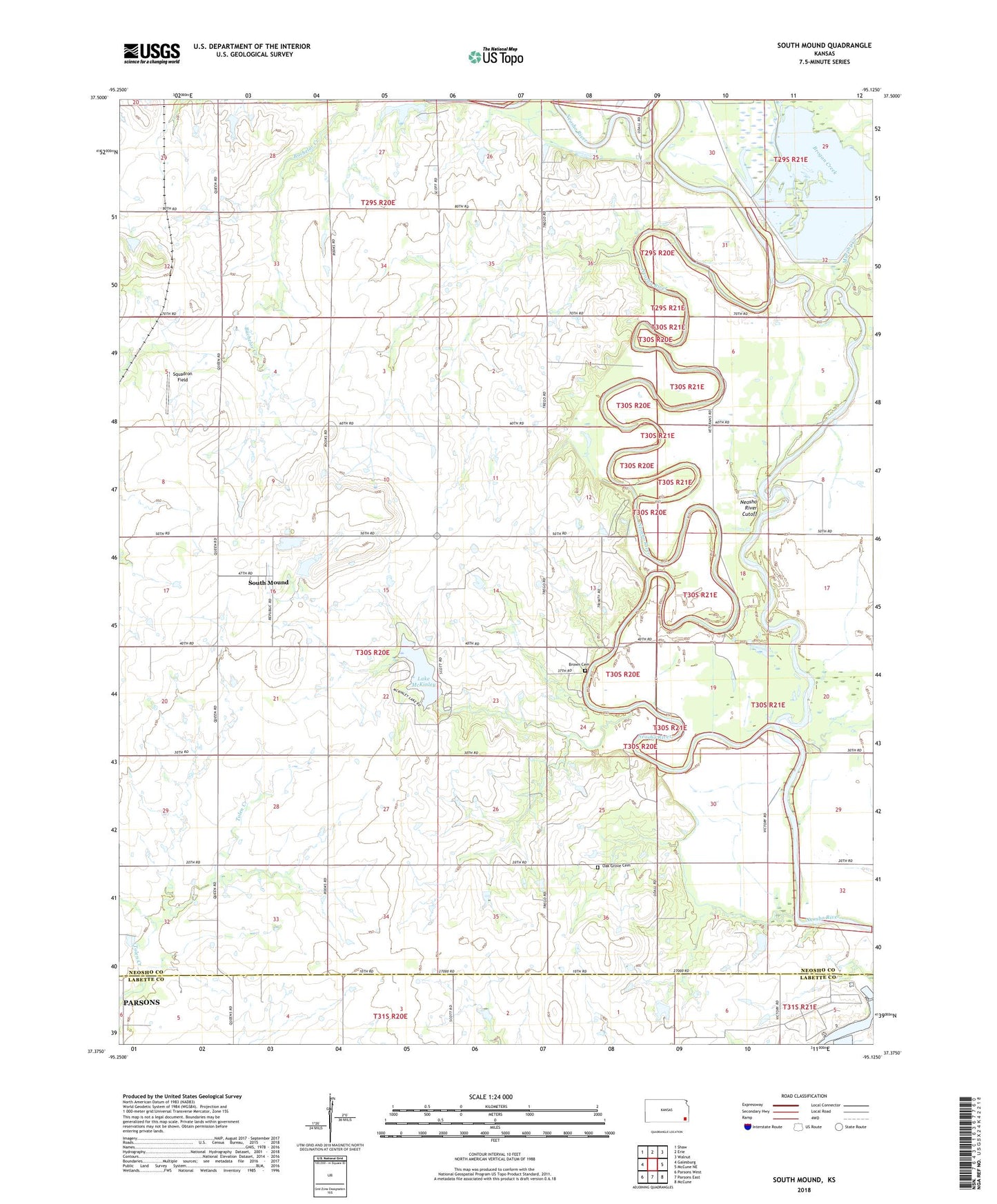
2022 topographic map quadrangle South Mound in the state of Kansas. Scale: 1:24000. Based on the newly updated USGS 7.5' US Topo map series, this map is in the following counties: Neosho, Labette. The map contains contour data, water features, and other items you are used to seeing on USGS maps, but also has updated roads and other features. This is the next generation of topographic maps. Printed on high-quality waterproof paper with UV fade-resistant inks.
Quads adjacent to this one:
West: Galesburg
Northwest: Shaw
North: Erie
Northeast: Walnut
East: McCune NE
Southeast: McCune
South: Parsons East
Southwest: Parsons West
This map covers the same area as the classic USGS quad with code o37095d2.
Contains the following named places: Bloomer School, Brogan Creek, Brown Cemetery, Grass Lake, Halfmoon Lake, Island School, Lake McKinley, Liberty School, Mentor School, Murphy Creek, Neosho County State Park Dam, Neosho River Cutoff, Neosho State Fishing Lake, Neosho Wildlife Area, Oak Grove Cemetery, Oak Grove School, Parsons Dam, South Mound, South Mound Census Designated Place, Squadron Field, Township of Lincoln, Union School, ZIP Code: 66771