MyTopo
Glasco NE Kansas US Topo Map
Couldn't load pickup availability
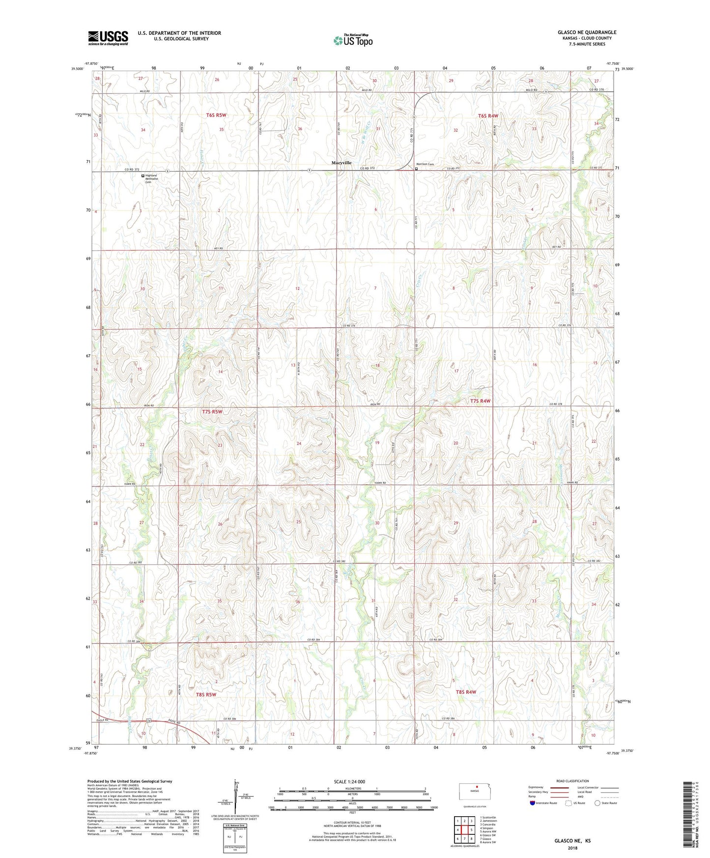
2022 topographic map quadrangle Glasco NE in the state of Kansas. Scale: 1:24000. Based on the newly updated USGS 7.5' US Topo map series, this map is in the following counties: Cloud. The map contains contour data, water features, and other items you are used to seeing on USGS maps, but also has updated roads and other features. This is the next generation of topographic maps. Printed on high-quality waterproof paper with UV fade-resistant inks.
Quads adjacent to this one:
West: Simpson
Northwest: Scottsville
North: Jamestown
Northeast: Concordia
East: Aurora NW
Southeast: Aurora SW
South: Glasco
Southwest: Glasco SW
This map covers the same area as the classic USGS quad with code o39097d7.
Contains the following named places: Cool, Fairview Elementary School, Highland School, Macyville, Morrison Cemetery, Silver Arrow School, Summit Cemetery, Summit Church, Township of Arion