MyTopo
Simpson Kansas US Topo Map
Couldn't load pickup availability
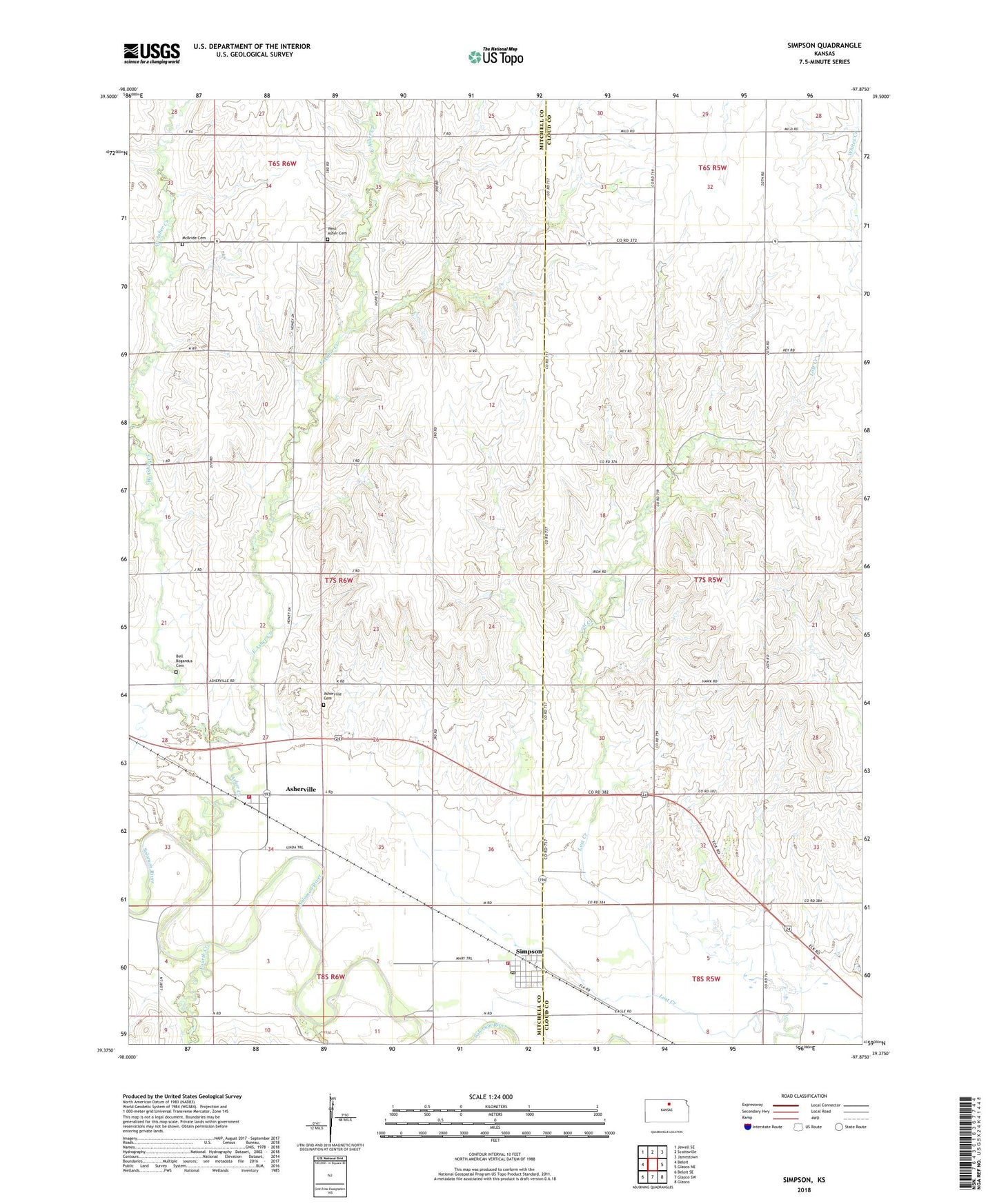
2022 topographic map quadrangle Simpson in the state of Kansas. Scale: 1:24000. Based on the newly updated USGS 7.5' US Topo map series, this map is in the following counties: Mitchell, Cloud. The map contains contour data, water features, and other items you are used to seeing on USGS maps, but also has updated roads and other features. This is the next generation of topographic maps. Printed on high-quality waterproof paper with UV fade-resistant inks.
Quads adjacent to this one:
West: Beloit
Northwest: Jewell SE
North: Scottsville
Northeast: Jamestown
East: Glasco NE
Southeast: Glasco
South: Glasco SW
Southwest: Beloit SE
This map covers the same area as the classic USGS quad with code o39097d8.
Contains the following named places: Agmark Grain Elevator Number 2, Asher Creek, Asherville, Asherville Cemetery, Asherville Census Designated Place, Bell Bogardus Cemetery, City of Simpson, East Asher Creek, Fourth Creek, Half Way, McBride Cemetery, Mitchell County Rural Fire District 1 Asherville Station, Mitchell County Rural Fire District 1 Simpson Station, Shanks Park, Simpson, Simpson Post Office, Township of Asherville, West Asher, West Asher Cemetery, West Asher Creek, ZIP Code: 67478