MyTopo
Jamestown Kansas US Topo Map
Couldn't load pickup availability
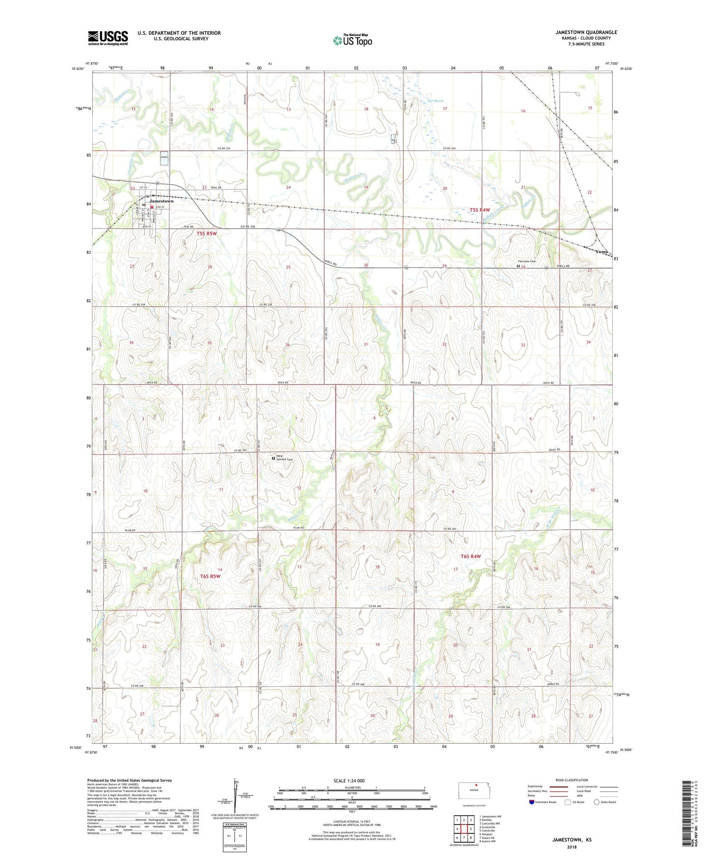
2022 topographic map quadrangle Jamestown in the state of Kansas. Scale: 1:24000. Based on the newly updated USGS 7.5' US Topo map series, this map is in the following counties: Cloud. The map contains contour data, water features, and other items you are used to seeing on USGS maps, but also has updated roads and other features. This is the next generation of topographic maps. Printed on high-quality waterproof paper with UV fade-resistant inks.
Quads adjacent to this one:
West: Scottsville
Northwest: Jamestown NW
North: Kackley
Northeast: Concordia NW
East: Concordia
Southeast: Aurora NW
South: Glasco NE
Southwest: Simpson
This map covers the same area as the classic USGS quad with code o39097e7.
Contains the following named places: Agmark Grain Elevator Number 9, Cheyenne Creek, City of Jamestown, Cloud County Rural Fire District 1 Jamestown, Fairview Cemetery, First United Methodist Church of Jamestown, Jamestown, Jamestown City Library, Jamestown Post Office, Jamestown Wastewater Plant, Marsh Creek, Salt Marsh, Township of Buffalo, Township of Summit, West Summit Cemetery, Whites Creek, ZIP Code: 66948