MyTopo
Scottsville Kansas US Topo Map
Couldn't load pickup availability
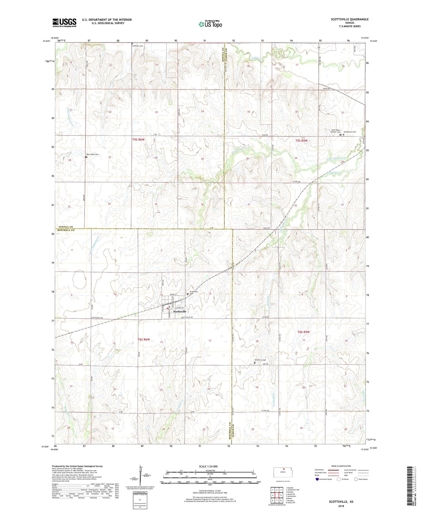
2022 topographic map quadrangle Scottsville in the state of Kansas. Scale: 1:24000. Based on the newly updated USGS 7.5' US Topo map series, this map is in the following counties: Cloud, Mitchell, Jewell. The map contains contour data, water features, and other items you are used to seeing on USGS maps, but also has updated roads and other features. This is the next generation of topographic maps. Printed on high-quality waterproof paper with UV fade-resistant inks.
Quads adjacent to this one:
West: Jewell SE
Northwest: Randall
North: Jamestown NW
Northeast: Kackley
East: Jamestown
Southeast: Glasco NE
South: Simpson
Southwest: Beloit
This map covers the same area as the classic USGS quad with code o39097e8.
Contains the following named places: Agmark Grain Elevator Number 16, City of Scottsville, Jamestown Cemetery, Little Cheyenne Creek, Lovseth Cemetery, Mitchell County Rural Fire District 1 Scottsville Station, Saint Marys Catholic Cemetery, Scottsville, Scottsville Cemetery, Summit 3 Cemetery, Township of Allen, Township of Grant, Township of Lulu, West Hope Cemetery