MyTopo
Globe Kansas US Topo Map
Couldn't load pickup availability
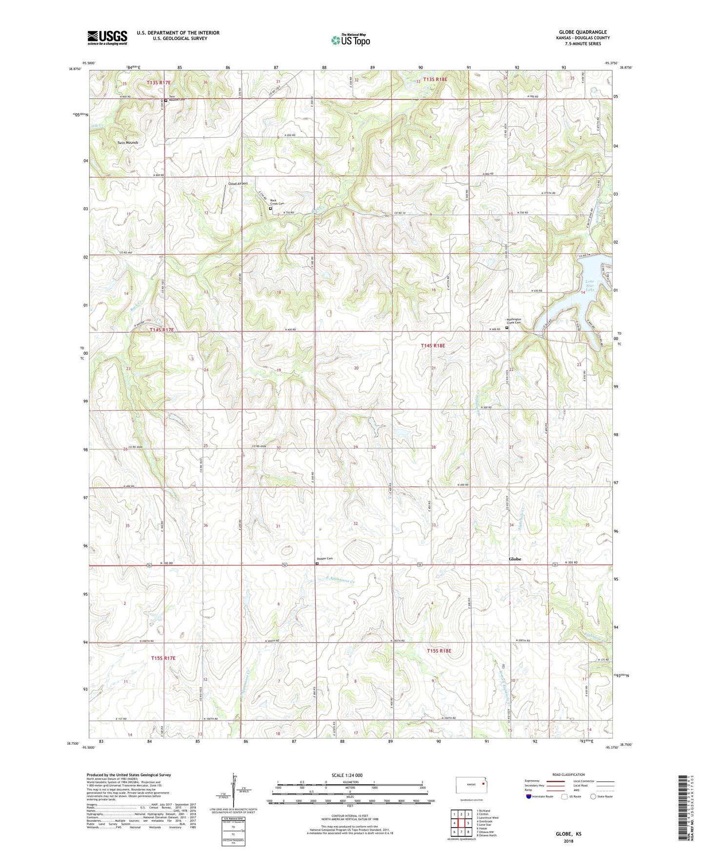
2022 topographic map quadrangle Globe in the state of Kansas. Scale: 1:24000. Based on the newly updated USGS 7.5' US Topo map series, this map is in the following counties: Douglas. The map contains contour data, water features, and other items you are used to seeing on USGS maps, but also has updated roads and other features. This is the next generation of topographic maps. Printed on high-quality waterproof paper with UV fade-resistant inks.
Quads adjacent to this one:
West: Overbrook
Northwest: Richland
North: Clinton
Northeast: Lawrence West
East: Lone Star
Southeast: Ottawa North
South: Ottawa NW
Southwest: Vassar
This map covers the same area as the classic USGS quad with code o38095g4.
Contains the following named places: Alfred, Baden, Bethel Chapel, Brubaker School, Centennial School, Cloud Airport, Dodder Cemetery, Enterprise School, Globe, Globe School, Lapeer, Lone Star Lake, Lone Star Lake Dam, Rock Creek Cemetery, Saint Francis Church, Township of Marion, Twin Mound, Twin Mounds, Twin Mounds Cemetery, Twin Mounds Church, Twin Mounds School, Washington Creek Cemetery, Washington Creek Church, Weybright School