MyTopo
Overbrook Kansas US Topo Map
Couldn't load pickup availability
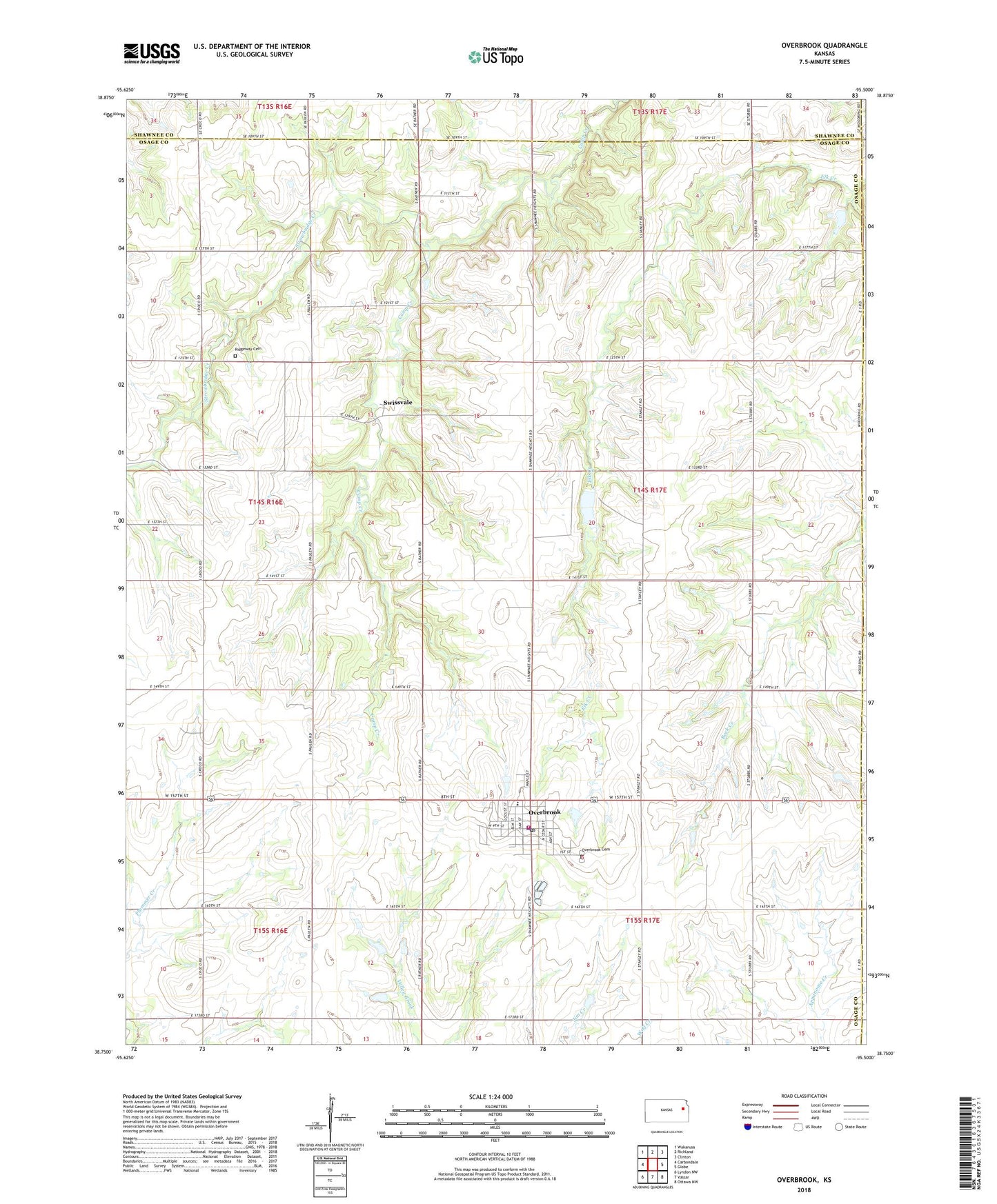
2022 topographic map quadrangle Overbrook in the state of Kansas. Scale: 1:24000. Based on the newly updated USGS 7.5' US Topo map series, this map is in the following counties: Osage, Shawnee, Douglas. The map contains contour data, water features, and other items you are used to seeing on USGS maps, but also has updated roads and other features. This is the next generation of topographic maps. Printed on high-quality waterproof paper with UV fade-resistant inks.
Quads adjacent to this one:
West: Carbondale
Northwest: Wakarusa
North: Richland
Northeast: Clinton
East: Globe
Southeast: Ottawa NW
South: Vassar
Southwest: Lyndon NW
This map covers the same area as the classic USGS quad with code o38095g5.
Contains the following named places: City of Overbrook, Grace Community Church, Hidden Springs Golf Course, Kinney, Lickskillet School, Osage County Fire District 4 Overbrook, Overbrook, Overbrook Attendance Center, Overbrook Bible Church, Overbrook Cemetery, Overbrook City Hall, Overbrook Fairgrounds, Overbrook Police Department, Overbrook Post Office, Overbrook Public Library, Overbrook Sewer Treatment Plant, Overbrook United Methodist Church, Overbrook Water Tower, Pleasant Valley School, Ridgeway Cemetery, Ridgeway School, Snoopys Airport, Strowbridge Creek, Swissvale, Township of Elk, ZIP Code: 66524