MyTopo
Goessel Kansas US Topo Map
Couldn't load pickup availability
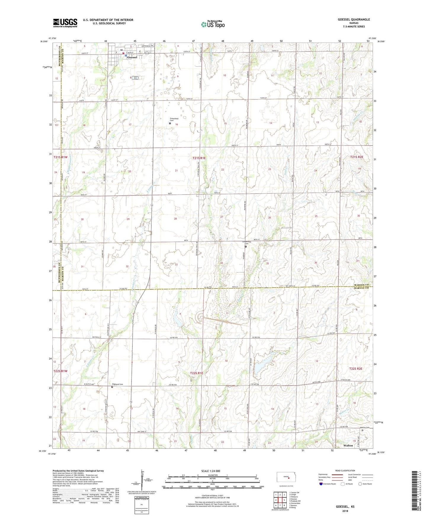
2022 topographic map quadrangle Goessel in the state of Kansas. Scale: 1:24000. Based on the newly updated USGS 7.5' US Topo map series, this map is in the following counties: Marion, Harvey, McPherson. The map contains contour data, water features, and other items you are used to seeing on USGS maps, but also has updated roads and other features. This is the next generation of topographic maps. Printed on high-quality waterproof paper with UV fade-resistant inks.
Quads adjacent to this one:
West: Hesston
Northwest: Canton SW
North: Lehigh
Northeast: Hillsboro
East: Peabody NW
Southeast: Elbing
South: Newton
Southwest: Zimmerdale
This map covers the same area as the classic USGS quad with code o38097b3.
Contains the following named places: Chisholm Trail Bible Church, City of Goessel, Emmenthal School, Gassel Oil Field, Goessel, Goessel City Hall, Goessel Elementary School, Goessel Junior / Senior High School, Goessel Mennonite Church, Goessel Police Department, Goessel Post Office, Goessel Public Library, Goessel Wastewater Treatment Plant, Green Valley School, Greenfield School, Groenfeld Cemetery, Heimbaugh School, Hiebert Airfield, Highland Cemetery, Highland Trinity United Church of Christ, Marion County Fire District 2 Goessel Fire Department, Mennonite Heritage and Agricultural Museum, Mennonite Heritage Museum, Sand Creek School, Schoenthal Cemetery, Tabor Mennonite Church, Team Marketing Alliance Grain Elevator Number 15, Township of Highland, Township of West Branch, Walton Cemetery, ZIP Codes: 67053, 67151