MyTopo
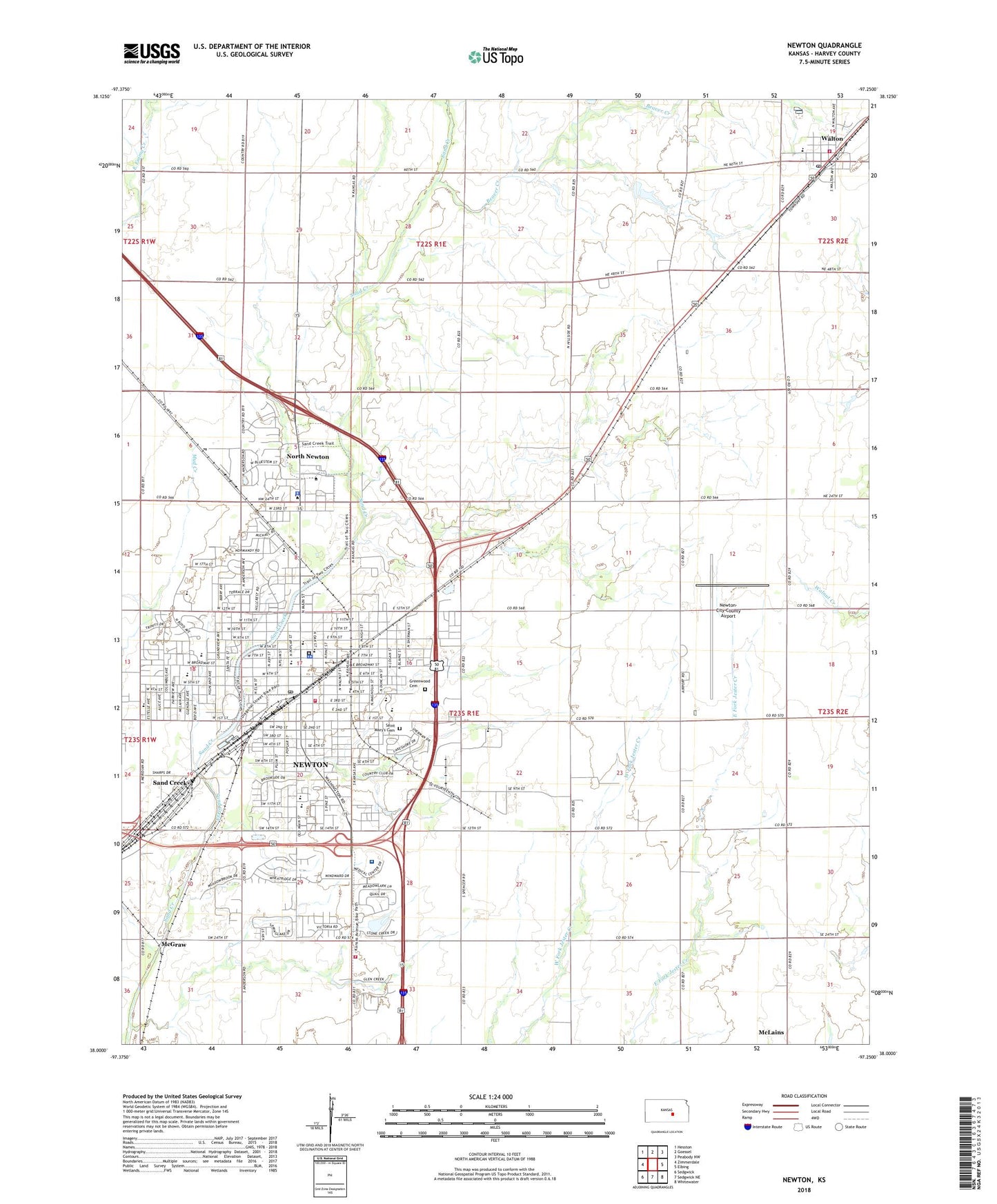
Newton Kansas US Topo Map
Couldn't load pickup availability
2022 topographic map quadrangle Newton in the state of Kansas. Scale: 1:24000. Based on the newly updated USGS 7.5' US Topo map series, this map is in the following counties: Harvey. The map contains contour data, water features, and other items you are used to seeing on USGS maps, but also has updated roads and other features. This is the next generation of topographic maps. Printed on high-quality waterproof paper with UV fade-resistant inks.
Quads adjacent to this one:
West: Zimmerdale
Northwest: Hesston
North: Goessel
Northeast: Peabody NW
East: Elbing
Southeast: Whitewater
South: Sedgwick NE
Southwest: Sedgwick
This map covers the same area as the classic USGS quad with code o38097a3.
Contains the following named places: All Nations Pentecostal Church, Asbury Park - Friendly Acres, Associated Mennonite Biblical Seminary - Great Plains Extension, Axtell Hospital, Beaver Creek, Bethel College, Bethel College Academic Center Old Science Hall, Bethel College Administration Building, Bethel College Fine Arts Center, Bethel College Franz Art Center, Bethel College Goering Hall, Bethel College Haury Hall, Bethel College Krehbiel Science Center, Bethel College Leisy Welcome Center, Bethel College Mantz Library, Bethel College Memorial Hall, Bethel College Mennonite Church, Bethel College Mennonite Library and Archives, Bethel College Schultz Student Center, Bethel College Thresher Gymnasium, Bethel College Thresher Stadium, Bethel College Voth Hall, Cedar Village Shopping Center, Central Kansas Area Vocational-Technical School, Chisholm Middle School, Church of Christ, Church of God of the Firstborn, City of Newton, City of North Newton, City of Walton, Columbus Avenue Church of Christ, Community Church of God, Cooper Early Education Center, Country Aire Mobile Home Park, Country Club Mobile Home Estates, Crossroads Community Church, East Emmett Church, East Side United Methodist Church, Eby Learning Center, Eightyone Airport, Faith Mennonite Church, Faith Temple Church of God in Christ, First Baptist Church, First Christian Church, First Church of God, First Church of the Nazarene, First Mennonite Church, First Missionary Church, First Presbyterian Church, First United Methodist Church, Fox Ridge Golf Club and Conference Center, Golden Plains Free Methodist Church, Grace Community Church, Greenwood Cemetery, Hall's Chapel African Methodist Episcopal Church, Harvey County Courthouse, Harvey County Detention Center, Harvey County Fairgrounds, Harvey County Fire District 1, Harvey County Health Department, Harvey County Historical Society, Harvey County Sheriff's Office, Hillcrest Community Church, Immanuel Baptist Church, Kansas Highway Patrol Troop F, Kansas National Guard Armory Newton, Kauffman Museum, KBCU - FM (North Newton), Kellas School, Kingdom Hall of Jehovah's Witnesses, KJRG-AM (Newton), Koerner Heights Church of the Mennonite Brethren, KoeZ-FM (Newton), Liberty Baptist Church, Lincoln Elementary School, McGraw, McKinley Administration Center, Meadow Lake Campground, Meridian Baptist Church, Midwest Lifeteam, N N Siding, New Creation Fellowship, New Life Assembly of God, Newton, Newton Amtrak Station, Newton Area Chamber of Commerce and Visitor's Bureau, Newton Bible Christian School, Newton Bible Church, Newton Christian Church, Newton Christian High School, Newton Church of the Brethren, Newton City Hall, Newton el Calvario Iglesia del Nazareno, Newton Fire / EMS Department Station 1, Newton Fire / EMS Department Station 3, Newton Fire and Emergency Medical Services Department Station 2, Newton High School, Newton Medical Center, Newton Police Department, Newton Post Office, Newton Public Golf Course, Newton Public Library, Newton Recreation Center, Newton Seventh Day Adventist Church, Newton United Church of Christ, Newton Wastewater Treatment Plant, Newton-City-County Airport, North Newton, North Newton City Hall, North Newton Police Department, North Newton Post Office, Northridge Elementary School, Old Main Street Church of Christ, Our Lady of Guadalupe Catholic Church, People's Bible Baptist Church, Prairie View Hospital, Prairie View Special Purpose School, Roosevelt Elementary School, Saint Luke Presbyterian Church, Saint Mary Catholic School, Saint Mary's Catholic Church, Saint Marys Cemetery, Saint Matthew's Episcopal Church, Salem United Methodist Church, Sand Creek, Sand Creek Station Golf Club, Santa Fe 5 - 6 Center, Santa Fe Middle School, Second Missionary Baptist Church, Shady Side School, Shalom Mennonite Church, Slate Creek Elementary School, South Breeze Elementary School, Stone School, Sunny Side School, Sunset Elementary School, Team Marketing Alliance Grain Elevator Number 26, Team Marketing Alliance Grain Elevator Number 29, Team Marketing Alliance Grain Elevator Number 35, The Church of Jesus Christ of Latter Day Saints, The Village Center, Themian Park, Township of Newton, Trinity Heights United Methodist Church, Walton, Walton Community Library, Walton Police Department, Walton Post Office, Walton Rural Life Center, Walton United Methodist Church, Walton Wastewater Treatment Facility, Washington Elementary School, Washington Park, Zion Lutheran Church, Zion Preschool, ZIP Codes: 67114, 67117


