MyTopo
Holland Kansas US Topo Map
Couldn't load pickup availability
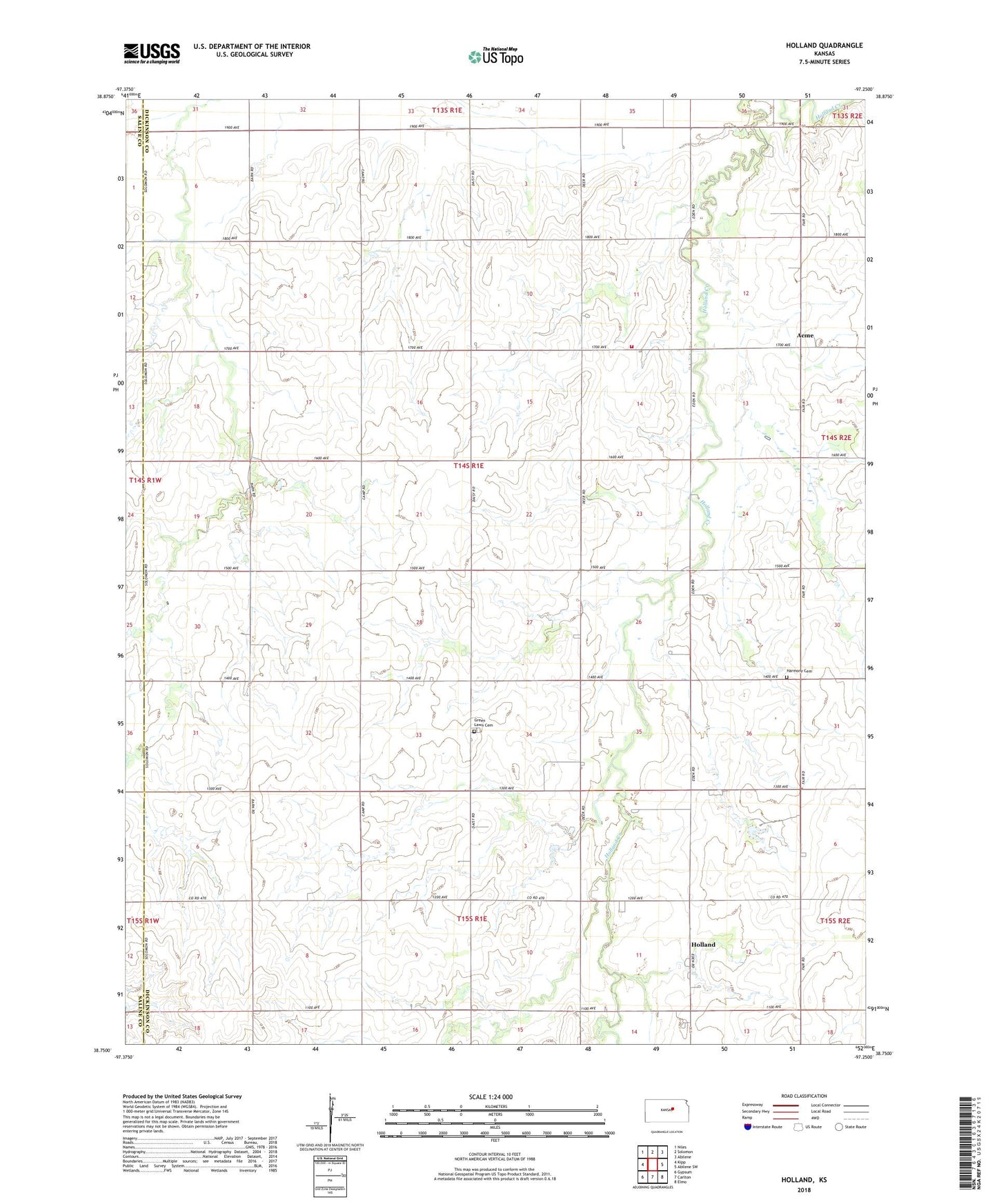
2022 topographic map quadrangle Holland in the state of Kansas. Scale: 1:24000. Based on the newly updated USGS 7.5' US Topo map series, this map is in the following counties: Dickinson, Saline. The map contains contour data, water features, and other items you are used to seeing on USGS maps, but also has updated roads and other features. This is the next generation of topographic maps. Printed on high-quality waterproof paper with UV fade-resistant inks.
Quads adjacent to this one:
West: Kipp
Northwest: Niles
North: Solomon
Northeast: Abilene
East: Abilene SW
Southeast: Elmo
South: Carlton
Southwest: Gypsum
This map covers the same area as the classic USGS quad with code o38097g3.
Contains the following named places: Acme, Grace and Truth Gospel Chapel, Green Lawn Cemetery, Harmony Cemetery, Holland, Mount Pleasant Evangelical Presbyterian Church, Saline County Fire District 1 - Garfield Township, Sunnyside, Township of Garfield