MyTopo
Carlton Kansas US Topo Map
Couldn't load pickup availability
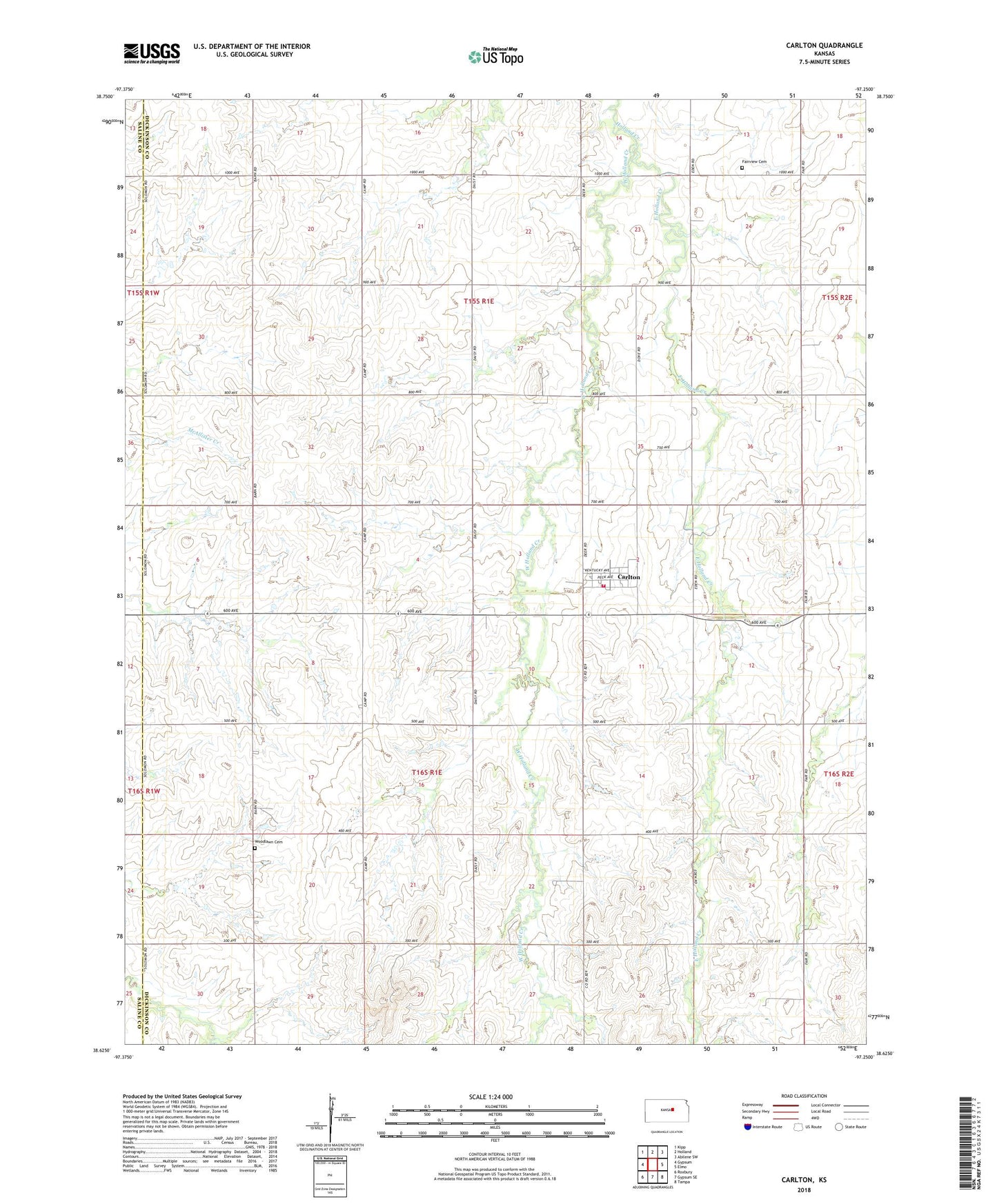
2022 topographic map quadrangle Carlton in the state of Kansas. Scale: 1:24000. Based on the newly updated USGS 7.5' US Topo map series, this map is in the following counties: Dickinson, Saline. The map contains contour data, water features, and other items you are used to seeing on USGS maps, but also has updated roads and other features. This is the next generation of topographic maps. Printed on high-quality waterproof paper with UV fade-resistant inks.
Quads adjacent to this one:
West: Gypsum
Northwest: Kipp
North: Holland
Northeast: Abilene SW
East: Elmo
Southeast: Tampa
South: Gypsum SE
Southwest: Roxbury
This map covers the same area as the classic USGS quad with code o38097f3.
Contains the following named places: Agricultural Producers Grain Elevator Number 2, Carlton, Carlton First Presbyterian Church, City of Carlton, East Holland Creek, Fairview Cemetery, Saline County Fire District 1 - Carlton Station, Township of Holland, Township of Wheatland, West Holland Creek, Woodlawn Cemetery