MyTopo
Abilene SW Kansas US Topo Map
Couldn't load pickup availability
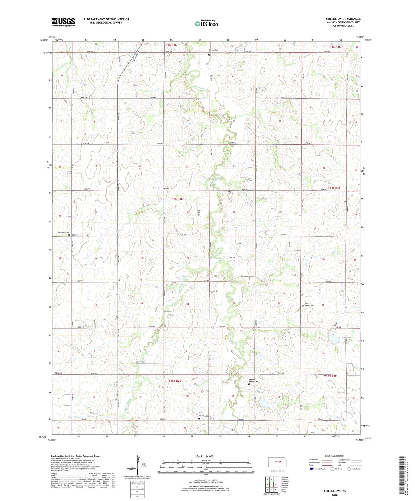
2022 topographic map quadrangle Abilene SW in the state of Kansas. Scale: 1:24000. Based on the newly updated USGS 7.5' US Topo map series, this map is in the following counties: Dickinson. The map contains contour data, water features, and other items you are used to seeing on USGS maps, but also has updated roads and other features. This is the next generation of topographic maps. Printed on high-quality waterproof paper with UV fade-resistant inks.
Quads adjacent to this one:
West: Holland
Northwest: Solomon
North: Abilene
Northeast: Chapman
East: Navarre
Southeast: Hope
South: Elmo
Southwest: Carlton
This map covers the same area as the classic USGS quad with code o38097g2.
Contains the following named places: Bell Spring, Belle Springs Cemetery, Dickinson County, Ebenezer Baptist Cemetery, Ebenezer Baptist Church, Farmington Cemetery, KSAJ - FM (Abilene), New Basel, New Basel Cemetery, New Basel United Church of Christ, Newburn Cemetery, Rural Center Church, Rural Center Elementary School, Township of Newbern, West Branch Turkey Creek