MyTopo
Holton Kansas US Topo Map
Couldn't load pickup availability
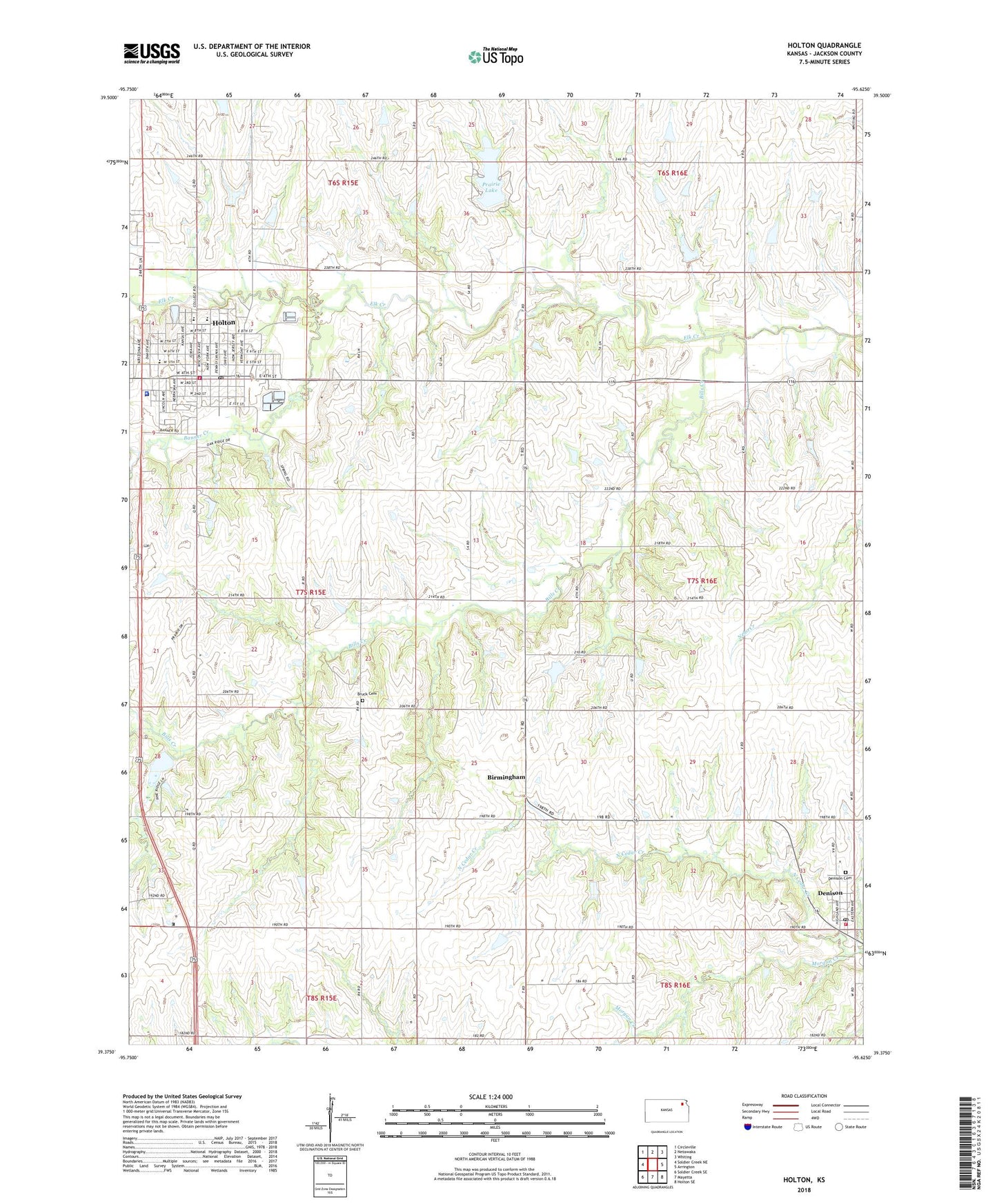
2022 topographic map quadrangle Holton in the state of Kansas. Scale: 1:24000. Based on the newly updated USGS 7.5' US Topo map series, this map is in the following counties: Jackson. The map contains contour data, water features, and other items you are used to seeing on USGS maps, but also has updated roads and other features. This is the next generation of topographic maps. Printed on high-quality waterproof paper with UV fade-resistant inks.
Quads adjacent to this one:
West: Soldier Creek NE
Northwest: Circleville
North: Netawaka
Northeast: Whiting
East: Arrington
Southeast: Holton SE
South: Mayetta
Southwest: Soldier Creek SE
This map covers the same area as the classic USGS quad with code o39095d6.
Contains the following named places: Banner Creek, Beck - Bookman Library, Bethany Baptist Church, Bills Creek, Birmingham, Brick Cemetery, Bruck School, Central Elementary School, City of Denison, City of Holton, Colorado Elementary School, Denison, Denison Bible Church, Denison Cemetery, Denison Elementary School, Denison Fire District Substation, Denison Post Office, Denison Reformed Presbyterian Church, Elk Horn Lake, Evangel United Methodist Church, First Baptist Church, First Christian Church, First Presbyterian Church of Holton, Holton, Holton - Jackson County Chamber of Commerce, Holton Church of the Nazarene, Holton City Dam, Holton City Hall, Holton Country Club, Holton Elementary School, Holton High School, Holton Middle School, Holton Municipal Power Plant, Holton Police Department, Holton Post Office, Holton Unified School District Office, Holton Volunteer Fire Department, Holton Wastewater Treatment, Jackson County Courthouse, Jackson County Department of Corrections, Jackson County Emergency Medical Services, Jackson County Fairgrounds, Jackson County Historical Society Museum, Jackson County Rural Fire District 4 Holton, Jackson County Sheriff's Office, Jackson Farmers Grain Elevator Number 1, Jackson Farmers Grain Elevator Number 2, Kansas Highway Patrol Troop B Jackson, Kansas National Guard Armory Holton, Kingdom Hall of Jehovah's Witnesses, Linscott Park, Meadow Acres Industrial Park, Morgan Creek, North Cedar, Northeast Kansas Multi - County Health Department Jackson County, Philo School, Prairie Lake, Rafters Park, Roebke Memorial Museum, Saint Dominic Catholic Church, Saint Thomas Episcopal Church, South Holton School, Township of Franklin, Township of Garfield, Word of Encouragement Family Church, ZIP Code: 66436