MyTopo
Whiting Kansas US Topo Map
Couldn't load pickup availability
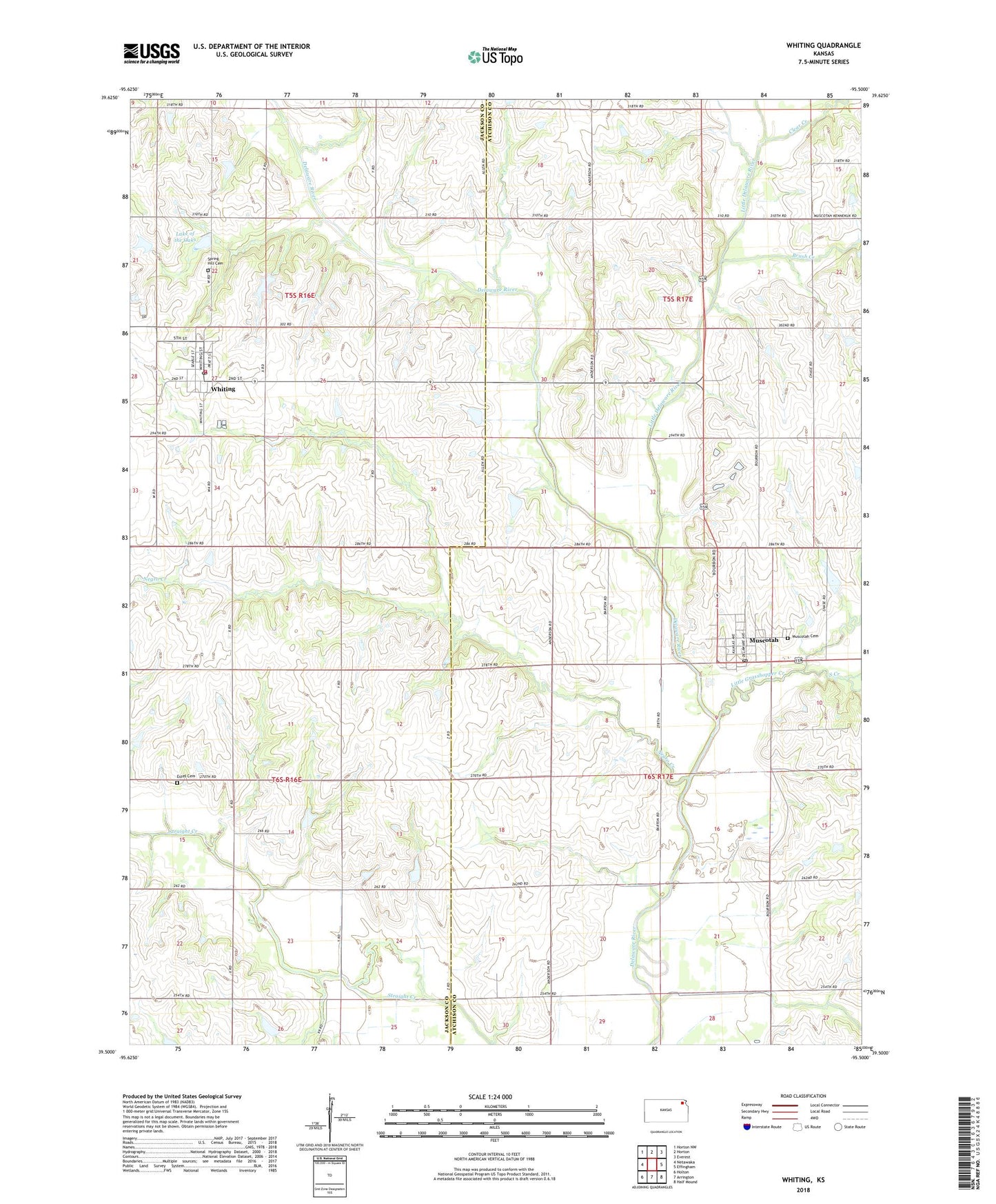
2022 topographic map quadrangle Whiting in the state of Kansas. Scale: 1:24000. Based on the newly updated USGS 7.5' US Topo map series, this map is in the following counties: Jackson, Atchison. The map contains contour data, water features, and other items you are used to seeing on USGS maps, but also has updated roads and other features. This is the next generation of topographic maps. Printed on high-quality waterproof paper with UV fade-resistant inks.
Quads adjacent to this one:
West: Netawaka
Northwest: Horton NW
North: Horton
Northeast: Everest
East: Effingham
Southeast: Half Mound
South: Arrington
Southwest: Holton
This map covers the same area as the classic USGS quad with code o39095e5.
Contains the following named places: Bodenhausen Farms, Brush Creek, City of Muscotah, City of Whiting, Clear Creek, Estes Cemetery, Jackson Farmers Grain Elevator Number 6, Lake of the Oaks, Little Delaware River, Little Grasshopper Creek, Muscotah, Muscotah Cemetery, Muscotah Post Office, Muscotah United Church, Muscotah Wastewater Treatment Facility, Negro Creek, New Mauldin School, Rose Hill School, Rose Valley School, South Creek, Spring Hill Cemetery, Township of Whiting, Walnut School, Whiting, Whiting Baptist Church, Whiting City Dam, Whiting Fire District 7, Whiting Post Office, Whiting United Methodist Church, Whiting Wastewater Treatment Facility, ZIP Code: 66058