MyTopo
Holyrood NW Kansas US Topo Map
Couldn't load pickup availability
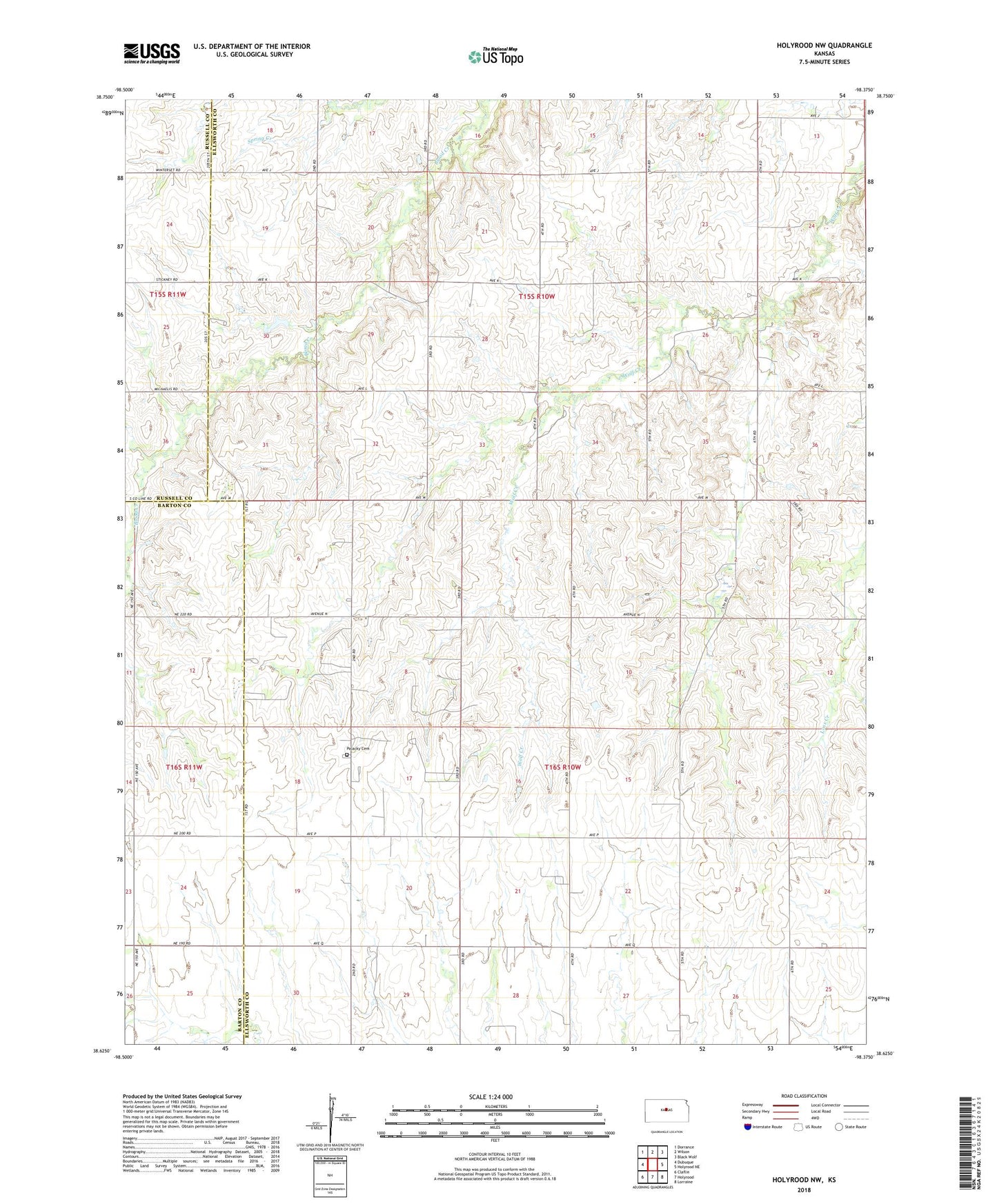
2022 topographic map quadrangle Holyrood NW in the state of Kansas. Scale: 1:24000. Based on the newly updated USGS 7.5' US Topo map series, this map is in the following counties: Ellsworth, Barton, Russell. The map contains contour data, water features, and other items you are used to seeing on USGS maps, but also has updated roads and other features. This is the next generation of topographic maps. Printed on high-quality waterproof paper with UV fade-resistant inks.
Quads adjacent to this one:
West: Dubuque
Northwest: Dorrance
North: Wilson
Northeast: Black Wolf
East: Holyrood NE
Southeast: Lorraine
South: Holyrood
Southwest: Claflin
This map covers the same area as the classic USGS quad with code o38098f4.
Contains the following named places: Alliance, Ellsworth County Dam, Holyrood Lake, Palacky, Palacky Cemetery, Progress Northwest Oil Field, Progress Oil Field, South Black Wolf School, Stoltenberg Oil Field, Township of Noble, Township of Palacky