MyTopo
Hope Kansas US Topo Map
Couldn't load pickup availability
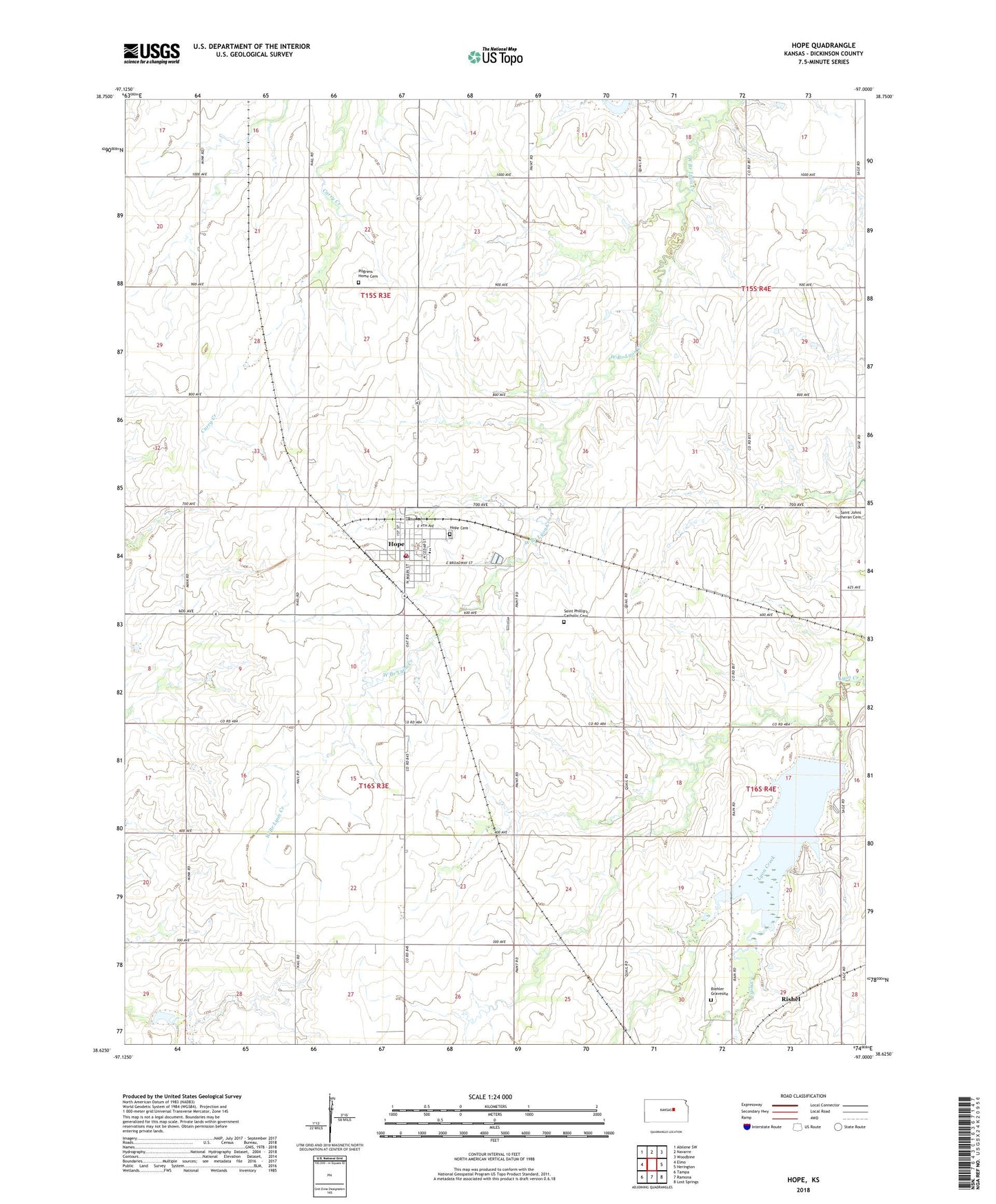
2022 topographic map quadrangle Hope in the state of Kansas. Scale: 1:24000. Based on the newly updated USGS 7.5' US Topo map series, this map is in the following counties: Dickinson. The map contains contour data, water features, and other items you are used to seeing on USGS maps, but also has updated roads and other features. This is the next generation of topographic maps. Printed on high-quality waterproof paper with UV fade-resistant inks.
Quads adjacent to this one:
West: Elmo
Northwest: Abilene SW
North: Navarre
Northeast: Woodbine
East: Herington
Southeast: Lost Springs
South: Ramona
Southwest: Tampa
This map covers the same area as the classic USGS quad with code o38097f1.
Contains the following named places: Biehler Gravesite, City of Hope, Herington Reservoir, Hope, Hope Cemetery, Hope City Hall, Hope Community Library, Hope High School, Hope Post Office, Hope Rural Fire Department Station 1, Hope Schools, Hope United Methodist Church, Hope Wastewater Plant, North Central Kansas Co - Operative Association Grain Elevator Number 1, Pilgrim Home Cemetery, Rishel, Saint Phillip Catholic Church, Saint Phillips Cemetery, Township of Hope, Township of Ridge, ZIP Code: 67451