MyTopo
Tampa Kansas US Topo Map
Couldn't load pickup availability
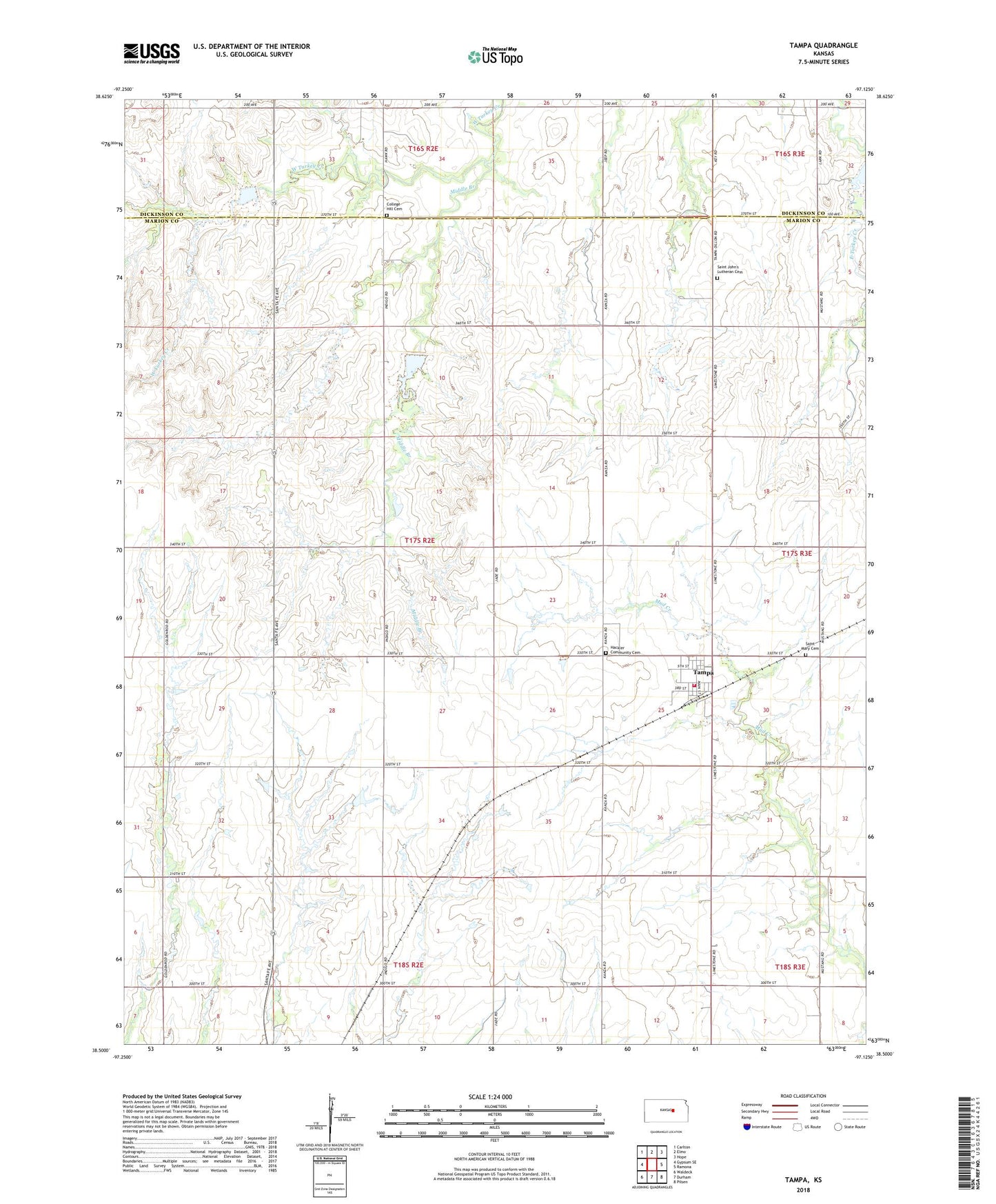
2022 topographic map quadrangle Tampa in the state of Kansas. Scale: 1:24000. Based on the newly updated USGS 7.5' US Topo map series, this map is in the following counties: Marion, Dickinson. The map contains contour data, water features, and other items you are used to seeing on USGS maps, but also has updated roads and other features. This is the next generation of topographic maps. Printed on high-quality waterproof paper with UV fade-resistant inks.
Quads adjacent to this one:
West: Gypsum SE
Northwest: Carlton
North: Elmo
Northeast: Hope
East: Ramona
Southeast: Pilsen
South: Durham
Southwest: Waldeck
This map covers the same area as the classic USGS quad with code o38097e2.
Contains the following named places: Agricultural Producers Grain Elevator Number 1, Bartholda School, City of Tampa, College Hill Cemetery, College Hill School, Durham Park, Gardner School, Hackler Community Cemetery, Marion County Fire District 7 Tampa Fire Department, Middle Branch, Red Top School, Saint Johns Lutheran Cemetery, Saint Mary Cemetery, Tampa, Tampa Wastewater Plant, Township of Blaine, ZIP Code: 67483