MyTopo
Ramona Kansas US Topo Map
Couldn't load pickup availability
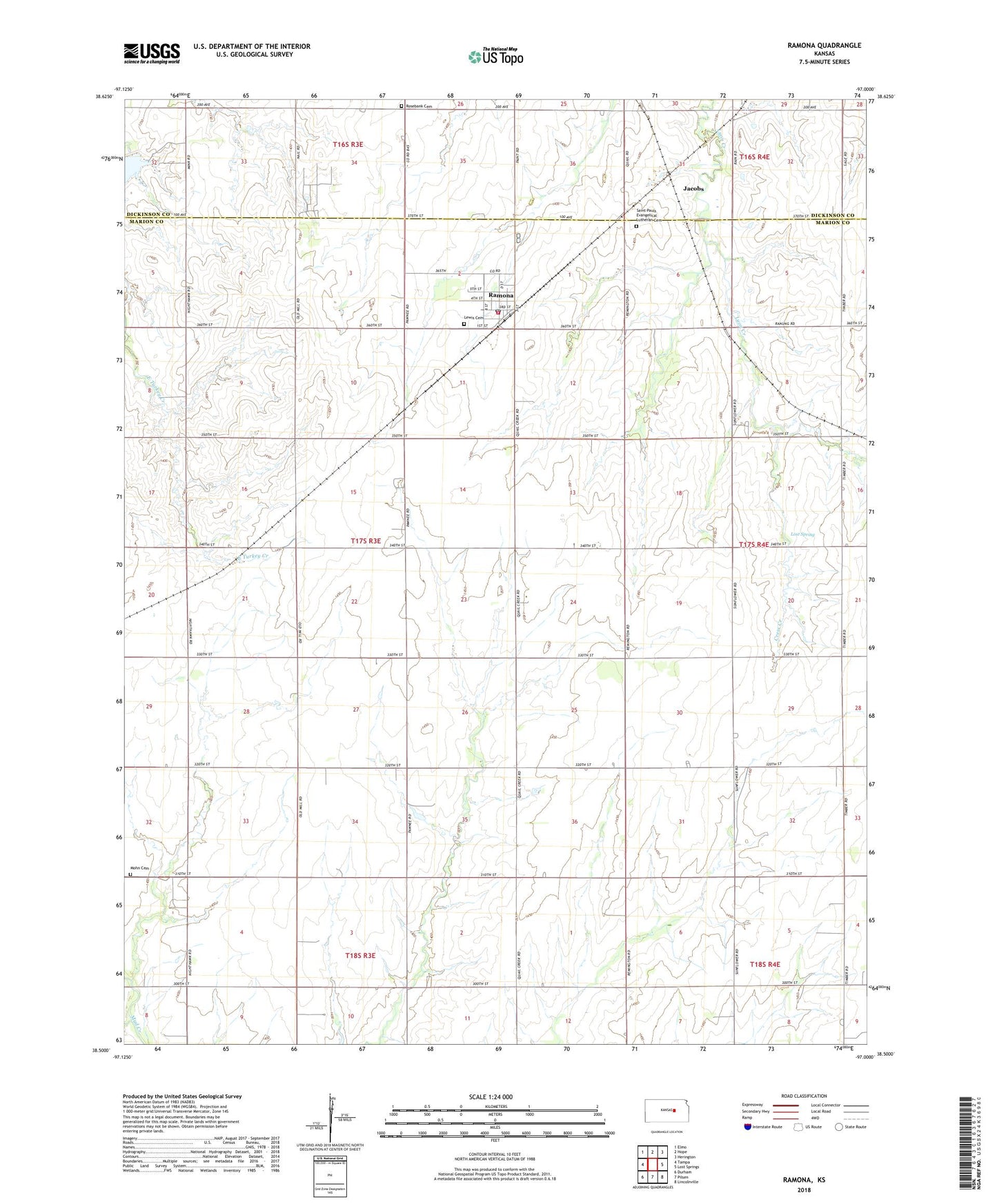
2022 topographic map quadrangle Ramona in the state of Kansas. Scale: 1:24000. Based on the newly updated USGS 7.5' US Topo map series, this map is in the following counties: Marion, Dickinson. The map contains contour data, water features, and other items you are used to seeing on USGS maps, but also has updated roads and other features. This is the next generation of topographic maps. Printed on high-quality waterproof paper with UV fade-resistant inks.
Quads adjacent to this one:
West: Tampa
Northwest: Elmo
North: Hope
Northeast: Herington
East: Lost Springs
Southeast: Lincolnville
South: Pilsen
Southwest: Durham
This map covers the same area as the classic USGS quad with code o38097e1.
Contains the following named places: Advent Church, Agricultural Producers Grain Elevator Number 7, City of Ramona, Comet School, Cress Creek, Dirt Gambler's Museum, Endeavor School, Flying N Ranch Airport, Highland School, Jacobs, Lewis Cemetery, Lost Spring, Marion County Fire District 3 Ramona Fire Department, Mohn Cemetery, Pleasant Hill School, Ramona, Ramona Post Office, Ramona Wastewater Plant, Rosebank Cemetery, Rosebank Church of the Brethren, Saint Pauls Church, Saint Pauls Evangelical Lutheran Cemetery, Smith School, Sunnyside School, Township of Colfax, Trinity Lutheran Church, ZIP Code: 67475