MyTopo
Hudson Kansas US Topo Map
Couldn't load pickup availability
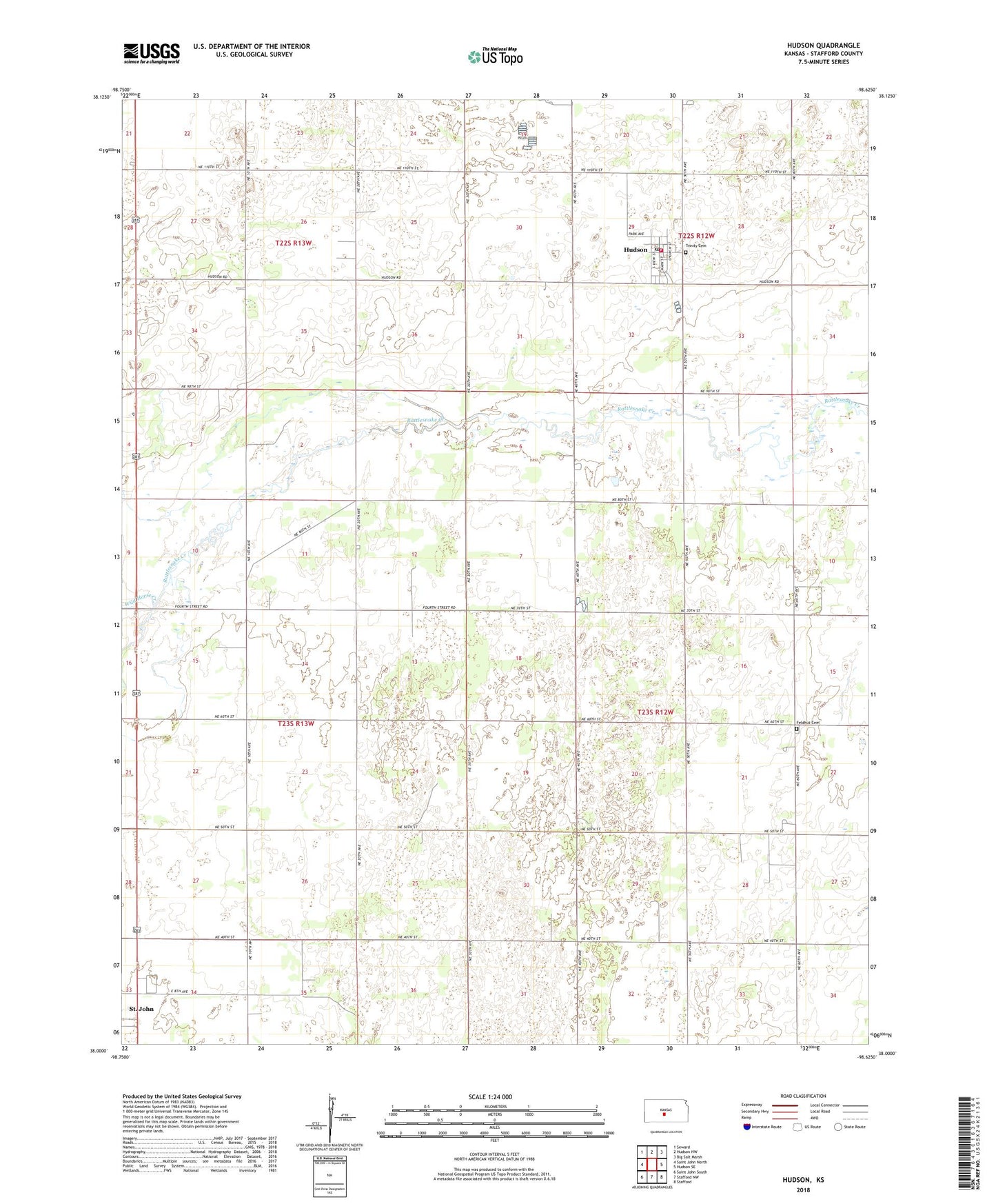
2022 topographic map quadrangle Hudson in the state of Kansas. Scale: 1:24000. Based on the newly updated USGS 7.5' US Topo map series, this map is in the following counties: Stafford. The map contains contour data, water features, and other items you are used to seeing on USGS maps, but also has updated roads and other features. This is the next generation of topographic maps. Printed on high-quality waterproof paper with UV fade-resistant inks.
Quads adjacent to this one:
West: Saint John North
Northwest: Seward
North: Hudson NW
Northeast: Big Salt Marsh
East: Hudson SE
Southeast: Stafford
South: Stafford NW
Southwest: Saint John South
This map covers the same area as the classic USGS quad with code o38098a6.
Contains the following named places: Bedford, City of Hudson, Feldhut Cemetery, Hudson, Hudson Community Hall, Hudson Middle School, Hudson Post Office, Hudson Wastewater Plant, New Hope United Methodist Church, Rattlesnake, St. John First United Methodist Church, Stafford County, Stafford County Flour Mills Grain Elevator Number 1, Stafford County Rural Fire Department Station 430, Township of St. John, Township of West Cooper, Trinity Cemetery, Trinity Community Church, Wild Horse Creek