MyTopo
Hutchinson NW Kansas US Topo Map
Couldn't load pickup availability
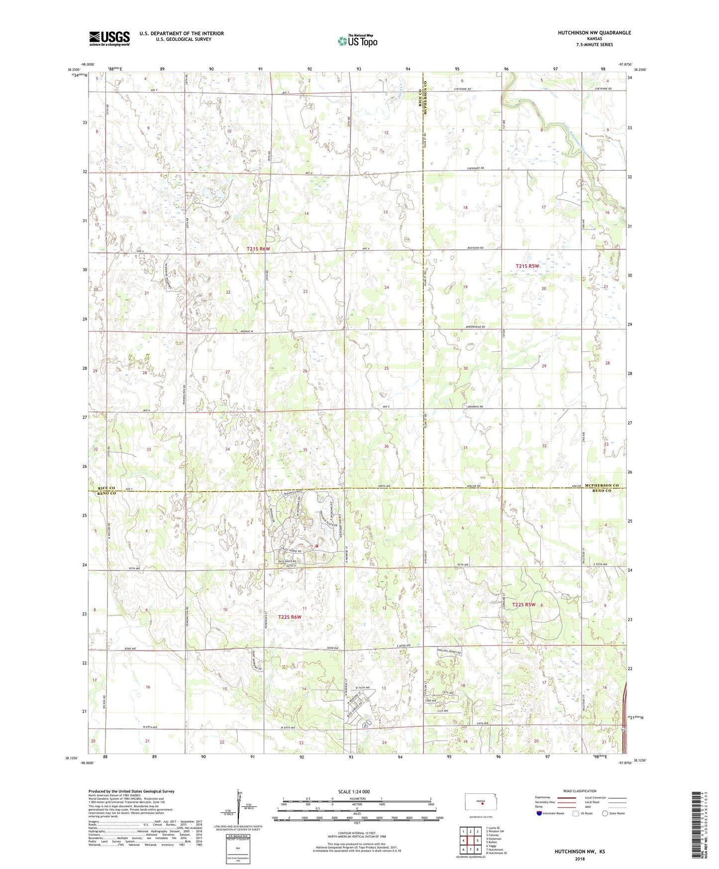
2022 topographic map quadrangle Hutchinson NW in the state of Kansas. Scale: 1:24000. Based on the newly updated USGS 7.5' US Topo map series, this map is in the following counties: Rice, Reno, McPherson. The map contains contour data, water features, and other items you are used to seeing on USGS maps, but also has updated roads and other features. This is the next generation of topographic maps. Printed on high-quality waterproof paper with UV fade-resistant inks.
Quads adjacent to this one:
West: Nickerson
Northwest: Lyons SE
North: Windom SW
Northeast: Conway
East: Buhler
Southeast: Hutchinson SE
South: Hutchinson
Southwest: Yaggy
This map covers the same area as the classic USGS quad with code o38097b8.
Contains the following named places: City of The Highlands, Reno County Blue Spruce Sewer District Number 3, Reno County Fire District 3 Station 2, The Highlands, The Highlands Golf Club, Thomas Grove School, Township of East Washington, ZIP Code: 67502