MyTopo
Nickerson Kansas US Topo Map
Couldn't load pickup availability
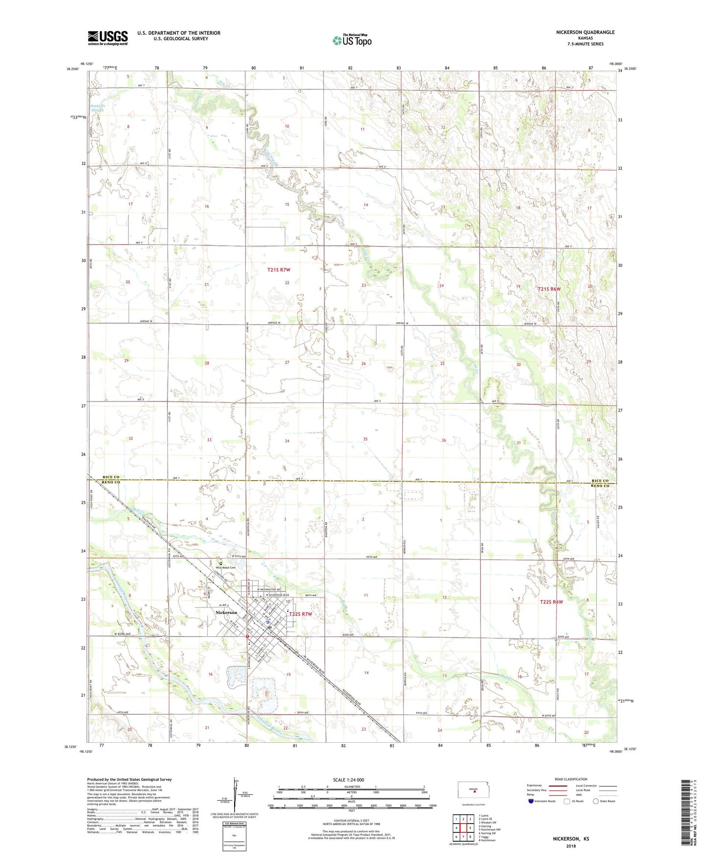
2022 topographic map quadrangle Nickerson in the state of Kansas. Scale: 1:24000. Based on the newly updated USGS 7.5' US Topo map series, this map is in the following counties: Rice, Reno. The map contains contour data, water features, and other items you are used to seeing on USGS maps, but also has updated roads and other features. This is the next generation of topographic maps. Printed on high-quality waterproof paper with UV fade-resistant inks.
Quads adjacent to this one:
West: Sterling
Northwest: Lyons
North: Lyons SE
Northeast: Windom SW
East: Hutchinson NW
Southeast: Hutchinson
South: Yaggy
Southwest: Sterling SW
This map covers the same area as the classic USGS quad with code o38098b1.
Contains the following named places: Christ Bible Church, City of Nickerson, Dry Creek, First Baptist Church of Nickerson, Nickerson, Nickerson City Hall, Nickerson Elementary School, Nickerson High School, Nickerson Police Department, Nickerson Post Office, Nickerson Public Library, Nickerson United Methodist Church, Paradise Pastures Golf Course, Reno County Fire District 3 Station 1, Sunview Mobile Home Park, Team Marketing Alliance Grain Elevator Number 30, Township of Grant, Township of West Washington, Wildmead Cemetery