MyTopo
Kingman NW Kansas US Topo Map
Couldn't load pickup availability
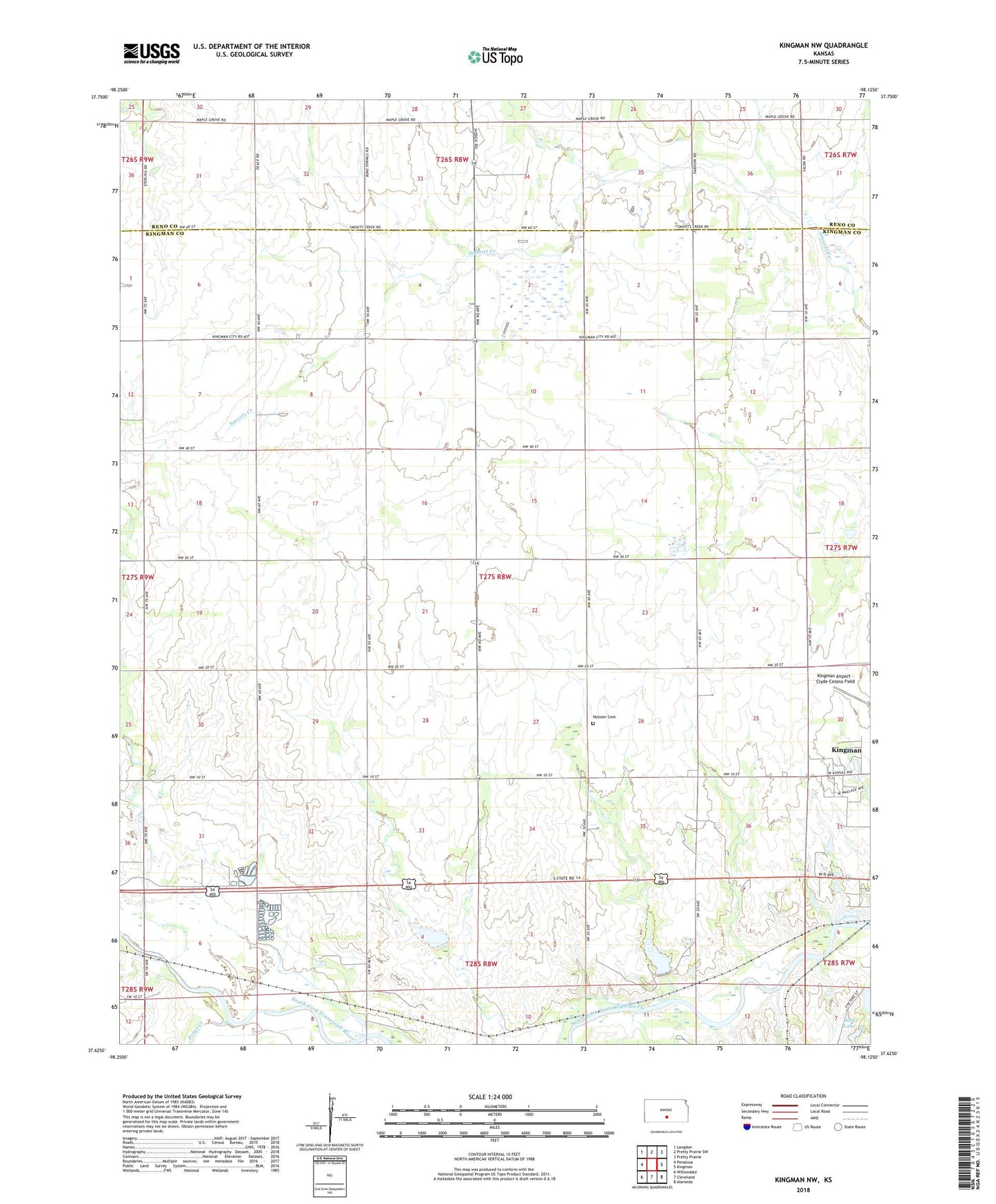
2022 topographic map quadrangle Kingman NW in the state of Kansas. Scale: 1:24000. Based on the newly updated USGS 7.5' US Topo map series, this map is in the following counties: Kingman, Reno. The map contains contour data, water features, and other items you are used to seeing on USGS maps, but also has updated roads and other features. This is the next generation of topographic maps. Printed on high-quality waterproof paper with UV fade-resistant inks.
Quads adjacent to this one:
West: Penalosa
Northwest: Langdon
North: Pretty Prairie SW
Northeast: Pretty Prairie
East: Kingman
Southeast: Alameda
South: Cleveland
Southwest: Willowdale
This map covers the same area as the classic USGS quad with code o37098f2.
Contains the following named places: Bock Lake, Browns Spur, Butler School, Hoosier Cemetery, Hoosier School, Kingman Country Club, Petyt Creek, Pleasant Hill School, Prairie Dell School, Riverside School, Sallee, Township of Hoosier, Woodford School