MyTopo
Penalosa Kansas US Topo Map
Couldn't load pickup availability
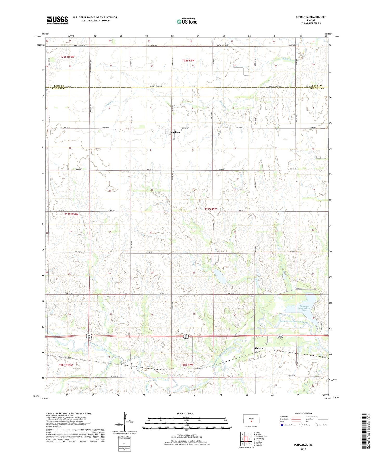
2022 topographic map quadrangle Penalosa in the state of Kansas. Scale: 1:24000. Based on the newly updated USGS 7.5' US Topo map series, this map is in the following counties: Kingman, Reno. The map contains contour data, water features, and other items you are used to seeing on USGS maps, but also has updated roads and other features. This is the next generation of topographic maps. Printed on high-quality waterproof paper with UV fade-resistant inks.
Quads adjacent to this one:
West: Cunningham
Northwest: Turon
North: Langdon
Northeast: Pretty Prairie SW
East: Kingman NW
Southeast: Cleveland
South: Willowdale
Southwest: Saint Leo
This map covers the same area as the classic USGS quad with code o37098f3.
Contains the following named places: Aurora School, Calista, City of Penalosa, Dresden, Dresden School, Kingman County State Lake, Kingman County State Lake Dam, Kingman State Fishing Lake and Wildlife Area, Lone Star School, Maud, Mead Creek, Painter Creek, Pat Creek, Penalosa, Penalosa Church of Christ, Penalosa United Methodist Church, Riverview School, Soudan, Sunny Slope School, Township of Eureka