MyTopo
Kirwin Reservoir Kansas US Topo Map
Couldn't load pickup availability
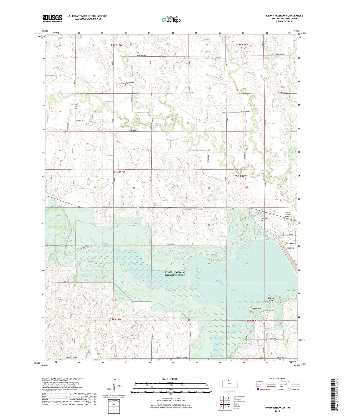
2022 topographic map quadrangle Kirwin Reservoir in the state of Kansas. Scale: 1:24000. Based on the newly updated USGS 7.5' US Topo map series, this map is in the following counties: Phillips. The map contains contour data, water features, and other items you are used to seeing on USGS maps, but also has updated roads and other features. This is the next generation of topographic maps. Printed on high-quality waterproof paper with UV fade-resistant inks.
Quads adjacent to this one:
West: Phillipsburg South
Northwest: Phillipsburg North
North: Gretna
Northeast: Kensington
East: Kirwin
Southeast: Kirwin SE
South: Kirwin SW
Southwest: Glade SE
This map covers the same area as the classic USGS quad with code o39099f2.
Contains the following named places: Big Creek, Bluegill Point, Bow Creek, Crappie Point, Eastern Heights Elementary School, Hillsdale Cemetery, Kirwin Cemetery, Kirwin Encampment, Kirwin National Wildlife Refuge, Kirwin Reservoir, Kirwin Wildlife Area, Plum Creek, Township of Deer Creek, Turner Creek, Wyrill Farming Airport, ZIP Code: 67644