MyTopo
Phillipsburg North Kansas US Topo Map
Couldn't load pickup availability
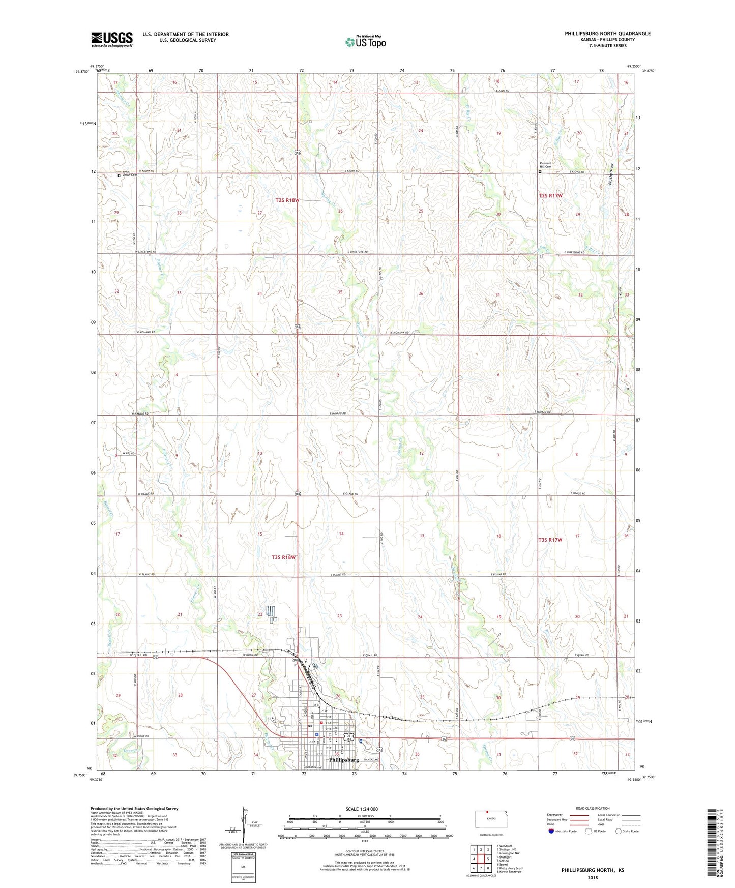
2022 topographic map quadrangle Phillipsburg North in the state of Kansas. Scale: 1:24000. Based on the newly updated USGS 7.5' US Topo map series, this map is in the following counties: Phillips. The map contains contour data, water features, and other items you are used to seeing on USGS maps, but also has updated roads and other features. This is the next generation of topographic maps. Printed on high-quality waterproof paper with UV fade-resistant inks.
Quads adjacent to this one:
West: Stuttgart
Northwest: Woodruff
North: Stuttgart NE
Northeast: Kensington NW
East: Gretna
Southeast: Kirwin Reservoir
South: Phillipsburg South
Southwest: Speed
This map covers the same area as the classic USGS quad with code o39099g3.
Contains the following named places: Brushy Draw, Calvary Baptist Church, Church of Christ, Churchill Airport, City of Phillipsburg, First Assembly of God Church, First Baptist Church, First Lutheran Church, First Presbyterian Church, Fort Bissell Museum, Iowa Union Cemetery, Jimtown, Kansas Highway Patrol Troop D Phillips, Kingdom Hall of Jehovah's Witnesses, KKAN-AM (Phillipsburg), Phillips County, Phillips County Courthouse, Phillips County Emergency Medical Services, Phillips County Health Department, Phillips County Hospital, Phillips County Sheriff's Office, Phillipsburg, Phillipsburg Area Chamber of Commerce, Phillipsburg City Hall, Phillipsburg City Library, Phillipsburg Fairgrounds, Phillipsburg Fire Department, Phillipsburg Golf Club, Phillipsburg Middle School, Phillipsburg Post Office, Phillipsburg United Methodist Church, Pleasant Hill Cemetery, Rangeland Co - Operative Grain Elevator Number 1, Township of Freedom, Township of Phillipsburg, Wesleyan Church, Worthen Post Office, Zion Lutheran Church, ZIP Code: 67661