MyTopo
Phillipsburg South Kansas US Topo Map
Couldn't load pickup availability
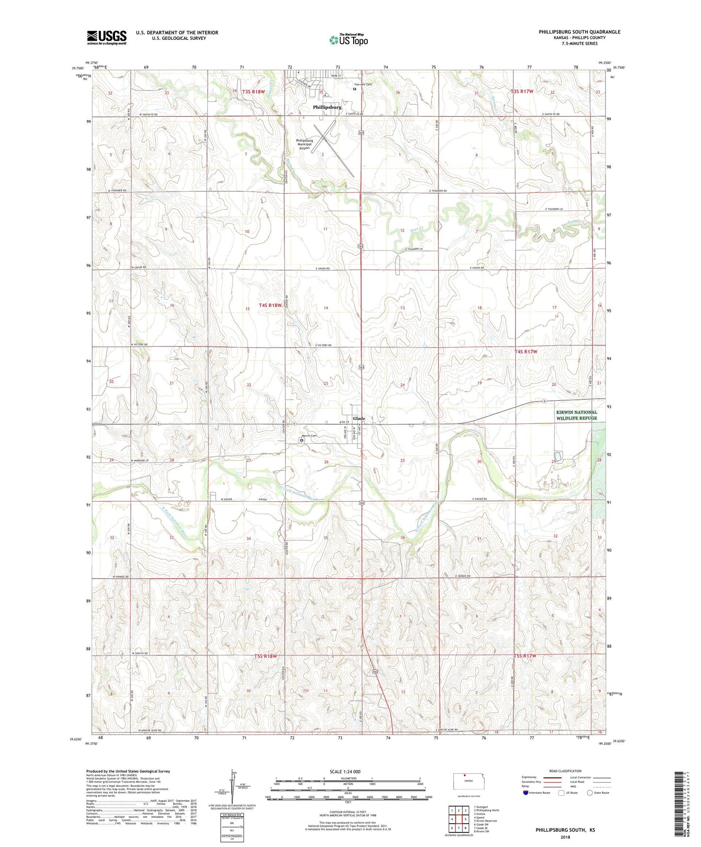
2022 topographic map quadrangle Phillipsburg South in the state of Kansas. Scale: 1:24000. Based on the newly updated USGS 7.5' US Topo map series, this map is in the following counties: Phillips. The map contains contour data, water features, and other items you are used to seeing on USGS maps, but also has updated roads and other features. This is the next generation of topographic maps. Printed on high-quality waterproof paper with UV fade-resistant inks.
Quads adjacent to this one:
West: Speed
Northwest: Stuttgart
North: Phillipsburg North
Northeast: Gretna
East: Kirwin Reservoir
Southeast: Kirwin SW
South: Glade SE
Southwest: Glade SW
This map covers the same area as the classic USGS quad with code o39099f3.
Contains the following named places: Church of God, City of Glade, Fairview Cemetery, First Christian Church, Glade, Marvin Cemetery, McDill Huck Boyd Community Center, Phillipsburg Elementary School, Phillipsburg High School, Phillipsburg Municipal Airport, Phillipsburg Wastewater Plant, Plotner Creek, Saints Philip and James Catholic Church, South Elementary School, Spring Creek, The Church of Jesus Christ of Latter Day Saints, Township of Solomon, ZIP Code: 67639