MyTopo
McCune Kansas US Topo Map
Couldn't load pickup availability
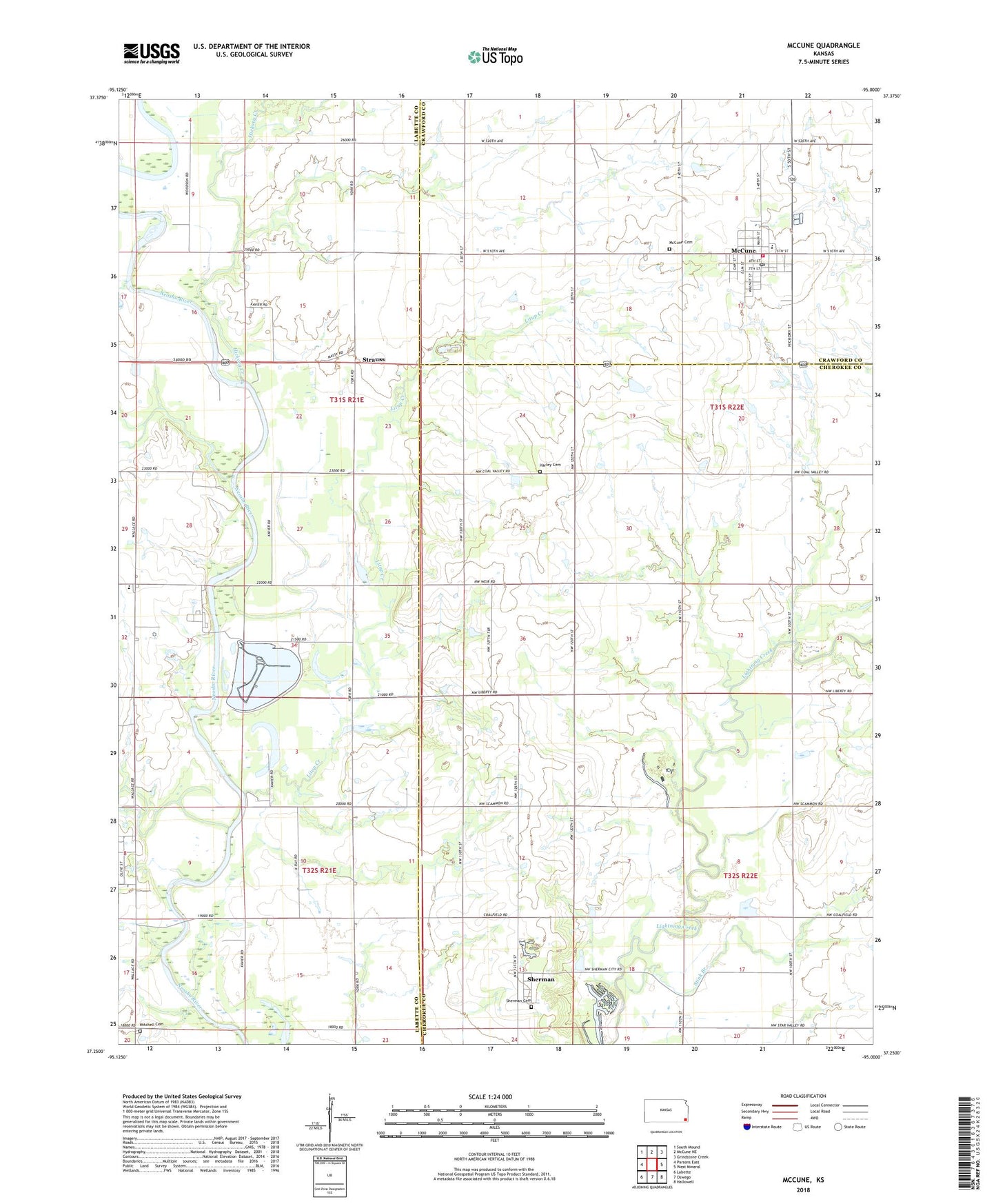
2022 topographic map quadrangle McCune in the state of Kansas. Scale: 1:24000. Based on the newly updated USGS 7.5' US Topo map series, this map is in the following counties: Labette, Cherokee, Crawford. The map contains contour data, water features, and other items you are used to seeing on USGS maps, but also has updated roads and other features. This is the next generation of topographic maps. Printed on high-quality waterproof paper with UV fade-resistant inks.
Quads adjacent to this one:
West: Parsons East
Northwest: South Mound
North: McCune NE
Northeast: Grindstone Creek
East: West Mineral
Southeast: Hallowell
South: Oswego
Southwest: Labette
This map covers the same area as the classic USGS quad with code o37095c1.
Contains the following named places: Center Valley School, City of McCune, Harley Cemetery, Harley School, Hickory Creek, Litup Creek, McCune, McCune Cemetery, McCune Church of Christ, McCune Church of the Nazarene, McCune City Hall, McCune Elementary School, McCune Farmers Union Co - Operative Association Grain Elevator Number 1, McCune Post Office, McCune Sewer Treatment Plant, McCune United Methodist Church, Mitchell Cemetery, Montana, Morrow School, New Hope School, Osage Township Fire Department, Pea Ridge School, Pleasant Hill School, Service Lake, Service Valley Charter Academy, Sherman, Sherman Cemetery, Stink Branch, Strauss, Township of Montana, Township of Neosho, Township of Sheridan, Valley School, Van Sluke School, ZIP Code: 66753