MyTopo
Lake Kahola Kansas US Topo Map
Couldn't load pickup availability
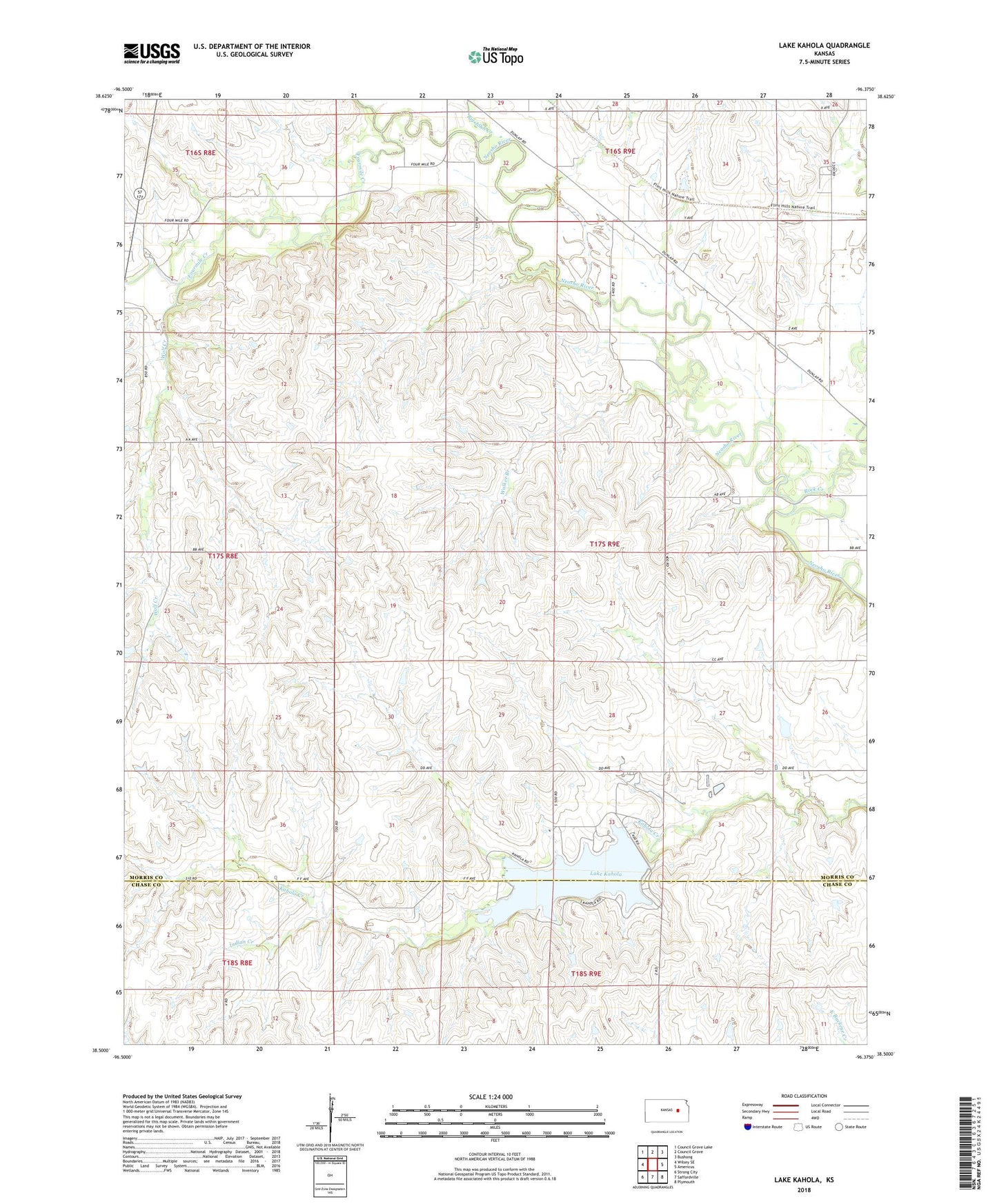
2022 topographic map quadrangle Lake Kahola in the state of Kansas. Scale: 1:24000. Based on the newly updated USGS 7.5' US Topo map series, this map is in the following counties: Morris, Chase. The map contains contour data, water features, and other items you are used to seeing on USGS maps, but also has updated roads and other features. This is the next generation of topographic maps. Printed on high-quality waterproof paper with UV fade-resistant inks.
Quads adjacent to this one:
West: Wilsey SE
Northwest: Council Grove Lake
North: Council Grove
Northeast: Bushong
East: Americus
Southeast: Plymouth
South: Saffordville
Southwest: Strong City
This map covers the same area as the classic USGS quad with code o38096e4.
Contains the following named places: Big John Creek, Fourmile Creek, Hinchman Ranch, Indian Creek, Lake Kahola, Rock Creek, Township 1, Walker Branch, Wolf Creek