MyTopo
Council Grove Lake Kansas US Topo Map
Couldn't load pickup availability
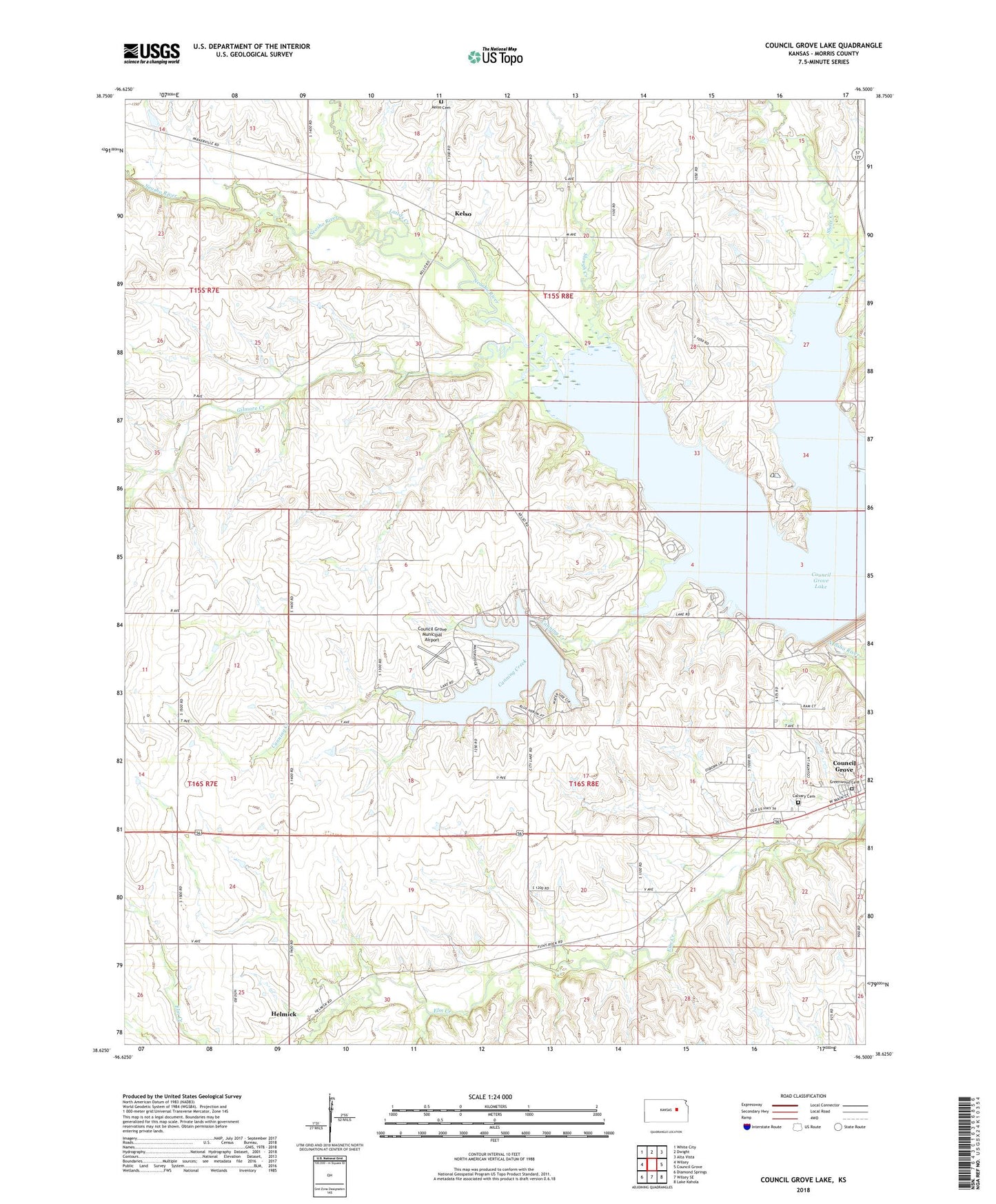
2022 topographic map quadrangle Council Grove Lake in the state of Kansas. Scale: 1:24000. Based on the newly updated USGS 7.5' US Topo map series, this map is in the following counties: Morris. The map contains contour data, water features, and other items you are used to seeing on USGS maps, but also has updated roads and other features. This is the next generation of topographic maps. Printed on high-quality waterproof paper with UV fade-resistant inks.
Quads adjacent to this one:
West: Wilsey
Northwest: White City
North: Dwight
Northeast: Alta Vista
East: Council Grove
Southeast: Lake Kahola
South: Wilsey SE
Southwest: Diamond Springs
This map covers the same area as the classic USGS quad with code o38096f5.
Contains the following named places: Calvary Cemetery, Canning Creek, Canning Creek Cove Recreation Area, Community Christian Church, Council Grove Country Club, Council Grove Dam, Council Grove Lake, Council Grove Municipal Airport, Council Grove Wildlife Area, Downing, First Baptist Church, Gieswein Farm, Gilmore Creek, Greenwood Cemetery, Helmick, Kelso, Kelso Cemetery, Kelso Church, Lairds Creek, Munkers Creek, Neosho Park Recreation Area, Richey Cove North Recreation Area, Ritchey Creek, Short Creek, Slash N Ranch, Slough Creek, White Memorial Camp