MyTopo
Plymouth Kansas US Topo Map
Couldn't load pickup availability
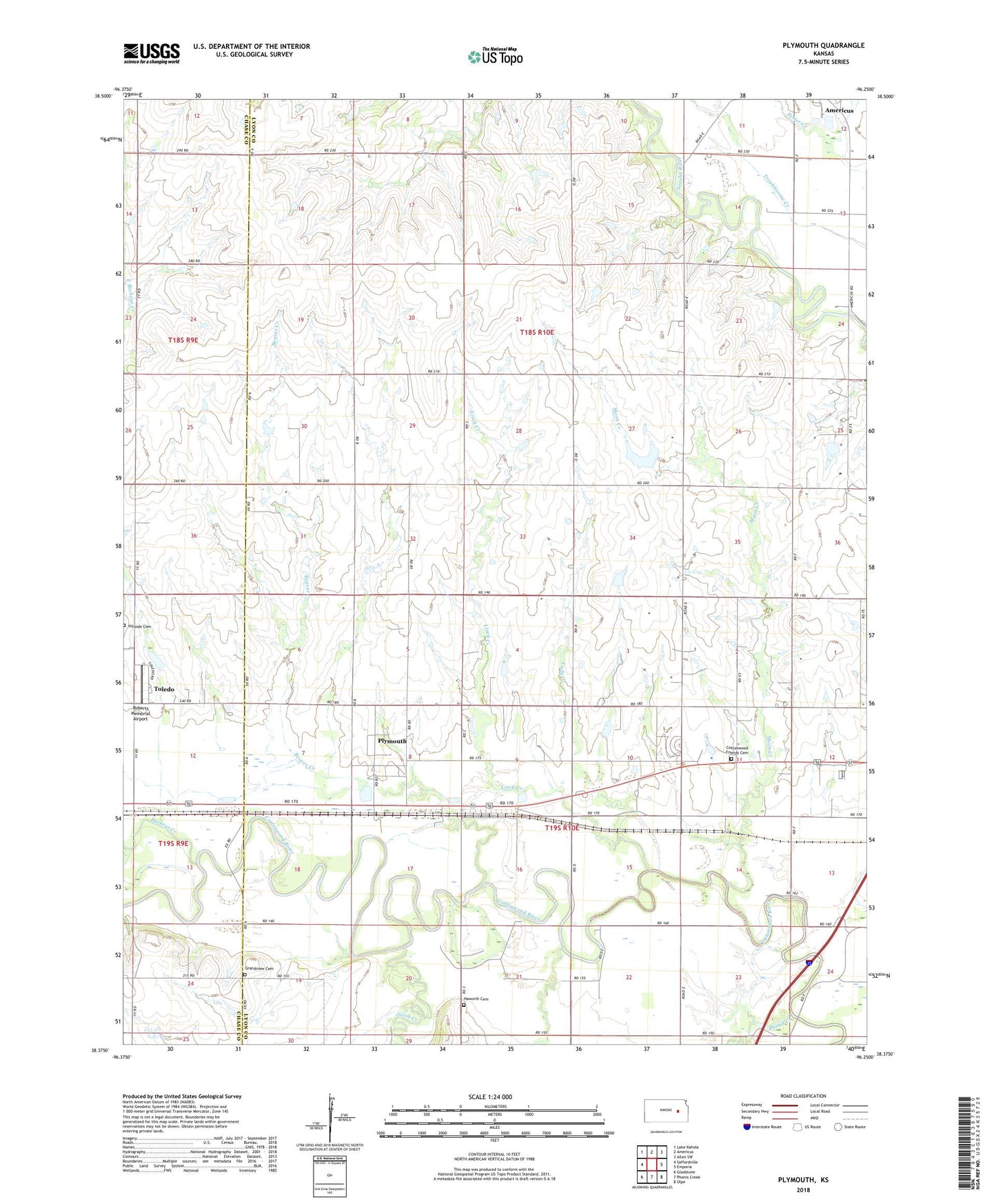
2022 topographic map quadrangle Plymouth in the state of Kansas. Scale: 1:24000. Based on the newly updated USGS 7.5' US Topo map series, this map is in the following counties: Lyon, Chase. The map contains contour data, water features, and other items you are used to seeing on USGS maps, but also has updated roads and other features. This is the next generation of topographic maps. Printed on high-quality waterproof paper with UV fade-resistant inks.
Quads adjacent to this one:
West: Saffordville
Northwest: Lake Kahola
North: Americus
Northeast: Allen SW
East: Emporia
Southeast: Olpe
South: Phenis Creek
Southwest: Gladstone
This map covers the same area as the classic USGS quad with code o38096d3.
Contains the following named places: Americus Wastewater Treatment Facility, Beaver Creek, Buckeye Creek, Cottonwood Friends Cemetery, Cottonwood Friends Church, Cottonwood School, Grandview Cemetery, Haworth Cemetery, Hayworth School, Heins Farm, Hillside Cemetery, Jacob Creek, Langley Farm, Leffler Farms, Linck Creek, Ludy Creek, Moon Creek, Orleans, Phenis Creek, Plymouth, Roberts Memorial Airport, Ruggles School, Saffordville United Methodist Church, Toledo, Township of Pike