MyTopo
Riley Kansas US Topo Map
Couldn't load pickup availability
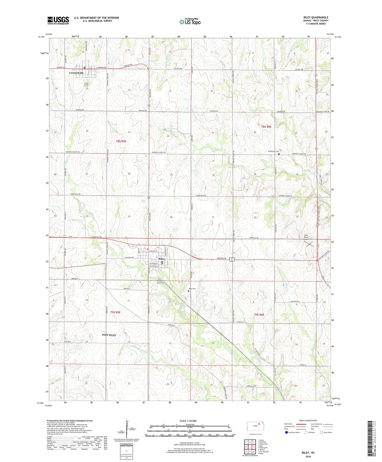
2022 topographic map quadrangle Riley in the state of Kansas. Scale: 1:24000. Based on the newly updated USGS 7.5' US Topo map series, this map is in the following counties: Riley. The map contains contour data, water features, and other items you are used to seeing on USGS maps, but also has updated roads and other features. This is the next generation of topographic maps. Printed on high-quality waterproof paper with UV fade-resistant inks.
Quads adjacent to this one:
West: Bala
Northwest: Lasita
North: Randolph
Northeast: Olsburg NW
East: Olsburg SW
Southeast: Keats
South: Fort Riley NE
Southwest: Milford
This map covers the same area as the classic USGS quad with code o39096c7.
Contains the following named places: Agmark Grain Elevator Number 12, Arts and Memories Museum, City of Leonardville, City of Riley, Crossroads Baptist Mission Church, Fairview Presbyterian Church, Leonardville, Leonardville City Library, Leonardville Golf Course, Leonardville Post Office, Leonardville United Methodist Church, Leonardville Wastewater Plant, Leo's Place Airport, Mill Creek Cemetery, Riley, Riley Airport, Riley Cemetery, Riley City Fire Department, Riley City Library, Riley County Fire District 1 Station 5, Riley County Fire District 1 Station 6, Riley County Grade School, Riley County High School, Riley First Presbyterian Church, Riley Post Office, Riley United Methodist Church, Riley Wastewater Treatment Facility, Township of Sherman, ZIP Code: 66531