MyTopo
Pilsen Kansas US Topo Map
Couldn't load pickup availability
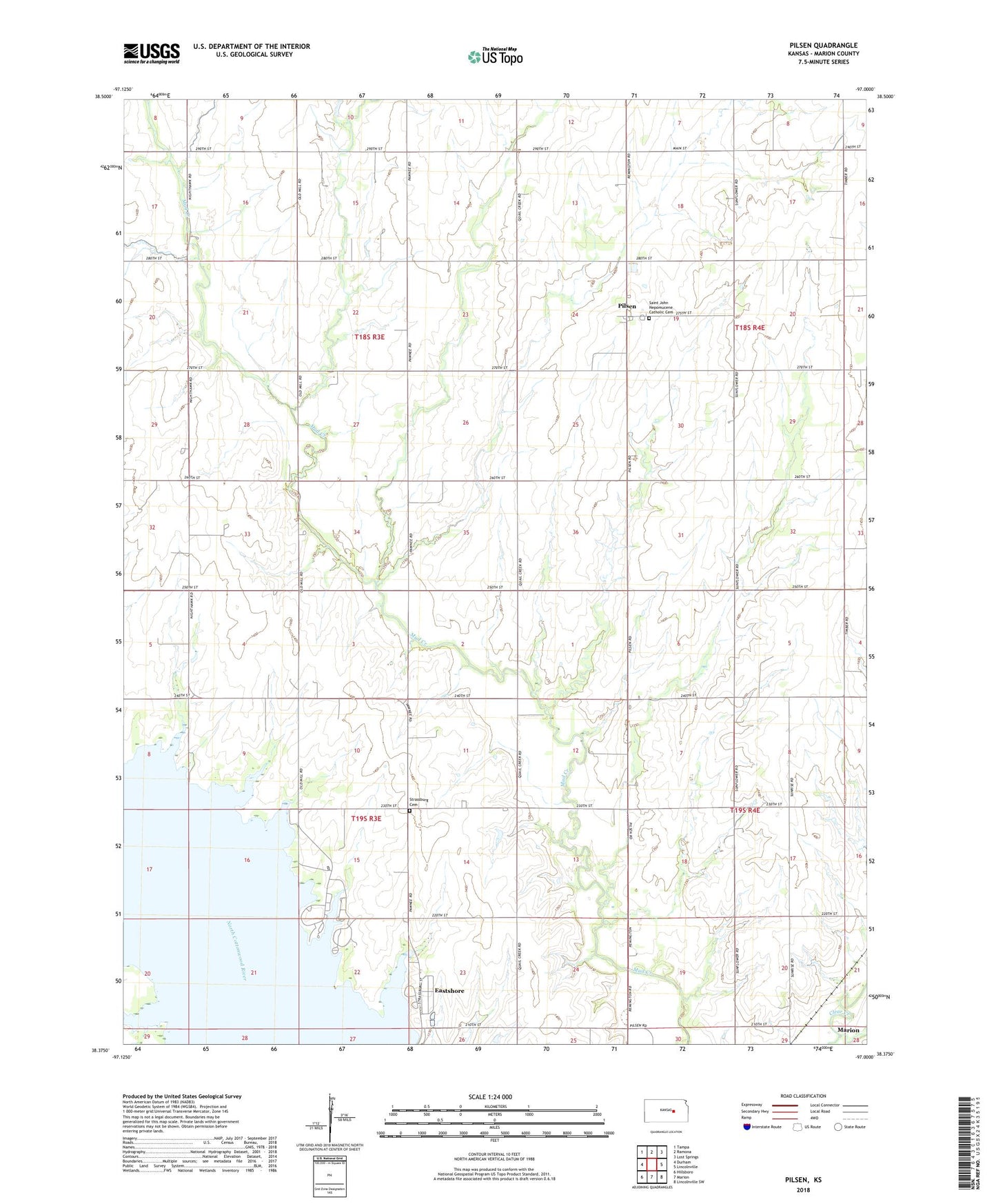
2022 topographic map quadrangle Pilsen in the state of Kansas. Scale: 1:24000. Based on the newly updated USGS 7.5' US Topo map series, this map is in the following counties: Marion. The map contains contour data, water features, and other items you are used to seeing on USGS maps, but also has updated roads and other features. This is the next generation of topographic maps. Printed on high-quality waterproof paper with UV fade-resistant inks.
Quads adjacent to this one:
West: Durham
Northwest: Tampa
North: Ramona
Northeast: Lost Springs
East: Lincolnville
Southeast: Lincolnville SW
South: Marion
Southwest: Hillsboro
This map covers the same area as the classic USGS quad with code o38097d1.
Contains the following named places: Beauty of the West School, Belton School, Clark School, Cottonwood Point Public Use Area, Cross School, Dobbs School, Eastshore, Eastshore Census Designated Place, Hutchins School, Kreutziger School, Marion Cove Public Use Area, Mud Creek, Pilsen, Pilsen Census Designated Place, Saint John Nepomucene Catholic Cemetery, Strassburg Baptist Church, Strassburg Cemetery, Township of Clark, Township of Gale, Wren School